
ESSEX COUNTY · VERMONT
Covered Bridges in Essex County
Explore Columbia and Mount Orne, two historic Connecticut River crossings linking northeastern Vermont with New Hampshire.
TWO STATES. ONE RIVER. HISTORIC TIMBER CROSSINGS.
Home / Covered Bridges / Essex County
DISCOVER THE CONNECTICUT RIVER VALLEY
Two crossings to build a visit around
This Essex County guide features Columbia Covered Bridge at Lemington and Mount Orne Covered Bridge at Lunenburg. Both cross the Connecticut River, with New Hampshire communities on the opposite bank.
Choose the crossing that fits your route, then leave time for the surrounding area. These are separate destinations, so check driving distances, current road conditions and posted restrictions before combining them in one outing.
LEMINGTON, VT ↔ COLUMBIA, NH
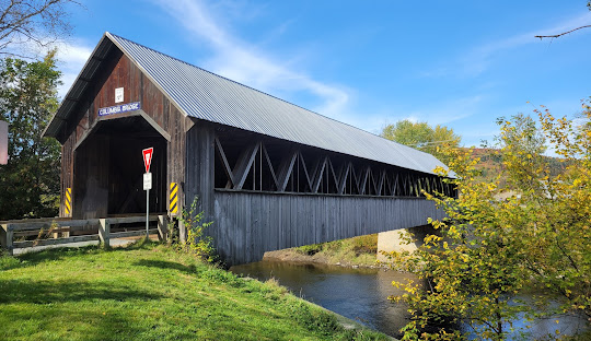
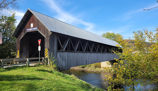
Columbia Covered Bridge
Columbia Covered Bridge carries Columbia Bridge Road across the Connecticut River between Lemington, Vermont, and Columbia, New Hampshire. Its Howe trusses combine timber members with iron tension rods, reflecting the bridge-building techniques of its era.
Location & approach
Research Columbia Bridge Road between VT Route 102 on the Vermont side and US Route 3 on the New Hampshire side. Use Lemington or Columbia with the bridge name when checking directions.
Before you visit: Check current access and posted vehicle limits. Choose a permitted place to stop without blocking the bridge or its approaches.
LUNENBURG, VT ↔ LANCASTER, NH
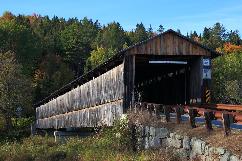
Mount Orne Covered Bridge
Mount Orne Covered Bridge spans the Connecticut River between Lunenburg, Vermont, and Lancaster, New Hampshire. Built in 1911, it is a Howe truss crossing with a different location from Columbia Bridge farther north.
Location & approach
On the Vermont side, research Mount Orne Bridge Road off River Road in Lunenburg. The New Hampshire approach connects toward NH Route 135 in South Lancaster. Use the bridge name and these towns to confirm the correct crossing.
Before you visit: Follow current closure signs and vehicle restrictions. Do not rely on historic inspection measurements as permission for a particular vehicle to cross.
PLAN A RELAXED RIVER-VALLEY OUTING
Make the route part of the day
Confirm the right crossing
For Columbia, use Lemington and Columbia as your destination towns. For Mount Orne, use Lunenburg and Lancaster. Similar regional names can make a wrong turn easy to miss.
Allow time between stops
Compare current driving distances before visiting both bridges. Build in time for a meal, village stop or a change of route, rather than assuming the crossings sit close together.
Visit thoughtfully
Keep roadways, bridge entrances and private driveways clear. Take photographs from safe, permitted places outside traffic lanes, and do not climb on bridge timbers.
Check weather and road conditions before leaving. Follow posted height, weight and access restrictions; this guide does not confirm that either bridge is open or suitable for your vehicle on the day of your visit.
Essex County covered-bridge questions
Which covered bridges are featured in this Essex County guide?
The guide features Columbia Covered Bridge at Lemington and Mount Orne Covered Bridge at Lunenburg. Both connect Vermont with New Hampshire across the Connecticut River.
Where is Columbia Covered Bridge?
It carries Columbia Bridge Road between Lemington, Vermont, and Columbia, New Hampshire, with approaches from VT Route 102 and US Route 3.
Where is Mount Orne Covered Bridge?
It connects Lunenburg, Vermont, with Lancaster, New Hampshire. Research Mount Orne Bridge Road and River Road on the Vermont side and the NH Route 135 area on the New Hampshire side.
Are these bridges entirely within Vermont?
They are interstate crossings over the Connecticut River. This guide includes them because their Vermont approaches are in Essex County.
Can I drive through both bridges?
Check current road notices and posted restrictions for each bridge and your vehicle. Do not assume that a map listing means a crossing is open or suitable for every vehicle.
KEEP EXPLORING VERMONT
Find another crossing along your route
Continue with the statewide bridge map and the background guide to Vermont’s covered bridges.