
Vermont's Covered Bridges - Washington County
WASHINGTON COUNTY · VERMONT
Covered Bridges in Washington County, Vermont
Explore 12 covered-bridge listings, from the Mad River Valley to Northfield, East Montpelier, Marshfield and Cabot, with photos and practical location notes.
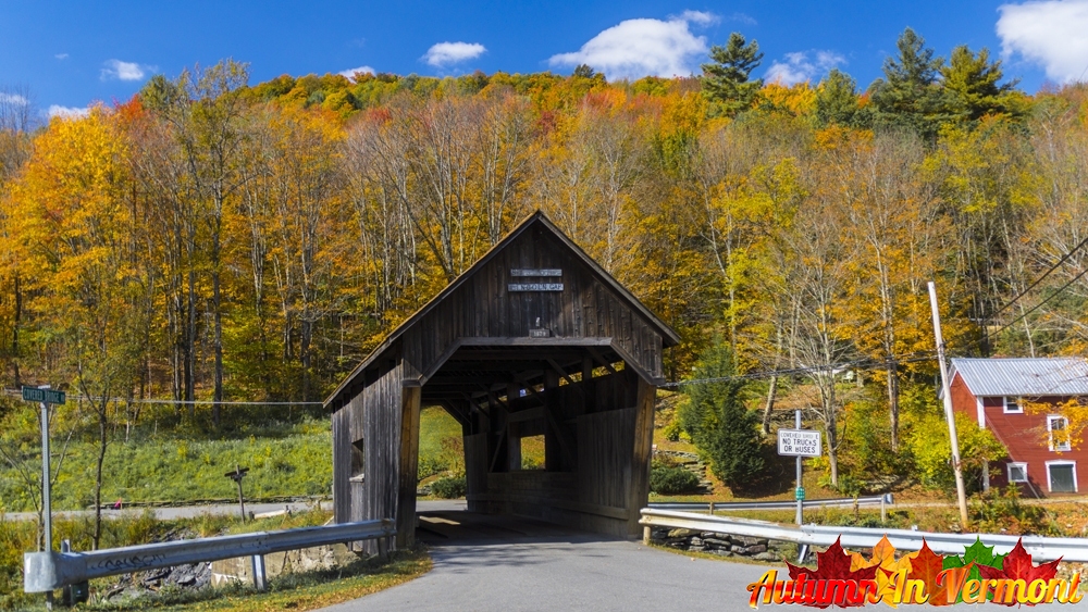
SUMMER ROADS. RIVER VIEWS. VERMONT BRIDGE STORIES.
Home / Covered Bridges / Washington County
FIND YOUR NEXT CROSSING
Explore Washington County’s covered bridges
Choose a cluster near your plans: Northfield’s river crossings, the Mad River Valley villages, or the bridge landscapes around East Montpelier, Marshfield and Cabot. Each area offers a different starting point for a Vermont drive.
All 12 listings include photographs and road names. Some bridges serve private property, while Martin is part of a park visit. Read the individual access notes and check local information before setting out.
CABOT
A.M. Foster Covered Bridge
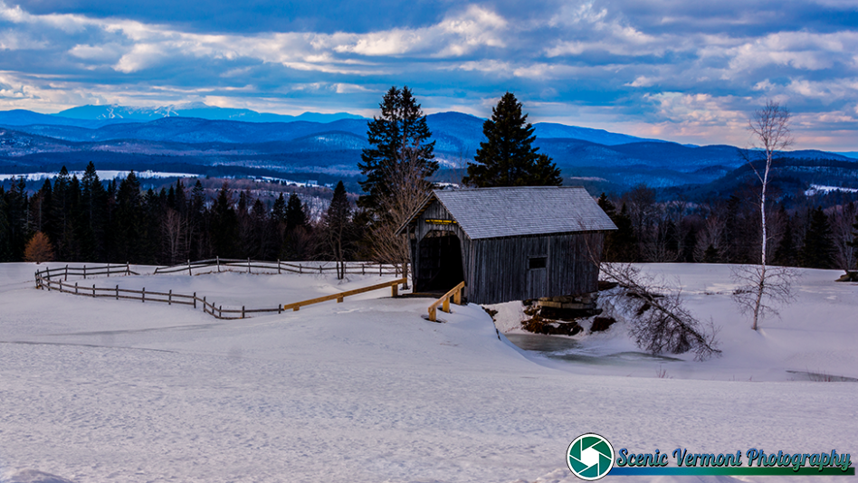
A later replica in a farm landscape
A.M. Foster Covered Bridge stands beside a pond on Cabot Plains Road. Built in the late 1980s, it draws on the design of Marshfield’s Martin Covered Bridge and adds a different chapter to the county’s bridge history.
Location & approach
Research Cabot Plains Road in Cabot. The bridge is on private property; check the owner’s current visitor guidance and obtain permission before entering fields or farm lanes.
EAST MONTPELIER
Coburn Covered Bridge
A Winooski River crossing
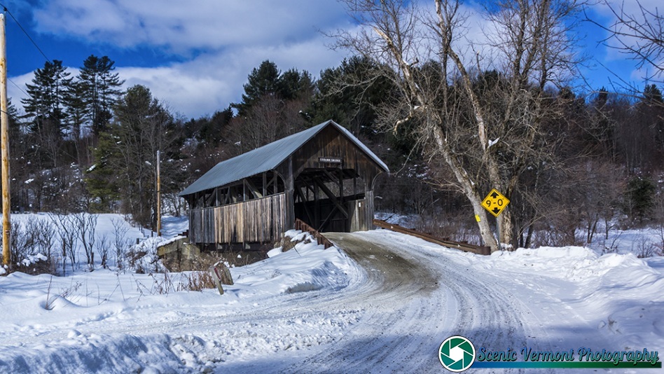
Coburn Covered Bridge carries Coburn Road over the Winooski River in East Montpelier. Its rural setting makes it a separate stop to consider along the US Route 2 corridor.
Location & approach
Look for Coburn Road off US Route 2 east of East Montpelier village. Confirm the bridge destination and current road conditions before traveling.
WAITSFIELD
Great Eddy Covered Bridge
Also known as Big Eddy or Waitsfield Covered Bridge
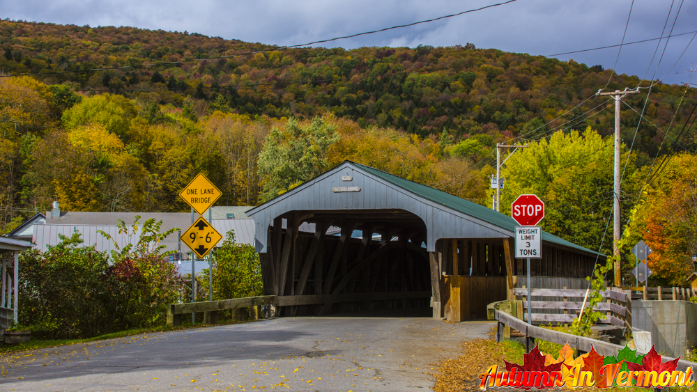
Great Eddy Covered Bridge crosses the Mad River on Bridge Street in Waitsfield. Its village location makes it a convenient landmark around which to plan a Mad River Valley outing.
Location & approach
Look for Bridge Street off VT Route 100 in Waitsfield village. Use permitted parking and keep the bridge entrance and traffic lanes clear.
NORTHFIELD FALLS
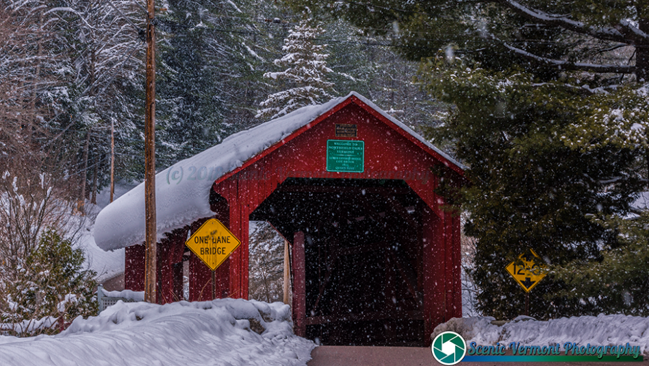
Lower Cox Brook Covered Bridge
One of the Cox Brook Road crossings
Lower Cox Brook Covered Bridge crosses Cox Brook in Northfield Falls. It is close to Northfield Falls Covered Bridge, which crosses the Dog River on the same road.
Location & approach
Follow Cox Brook Road west from VT Route 12 in Northfield Falls. Use each bridge’s full name to distinguish the nearby crossings.
MARSHFIELD
Martin Covered Bridge
A bridge within a town park
Martin Covered Bridge spans the Winooski River at Martin Covered Bridge Park in Marshfield. The town describes the park as a walking destination with parking off US Route 2.
Location & approach
Use the park’s Route 2 parking area and follow current site signs. Confirm bridge and trail access with the town before visiting; park access does not automatically mean the bridge is open to walk across.
NORTHFIELD FALLS
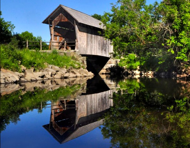
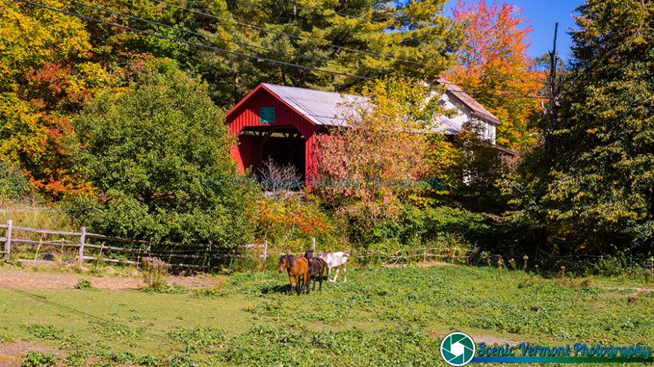
Northfield Falls Covered Bridge
Also known as Station Covered Bridge
Northfield Falls Covered Bridge carries Cox Brook Road across the Dog River. It belongs to the cluster of three covered bridges along this road, together with Lower and Upper Cox Brook.
Location & approach
Look for Cox Brook Road immediately west of VT Route 12 in Northfield Falls. Take care around traffic when viewing the nearby bridges.
WAITSFIELD
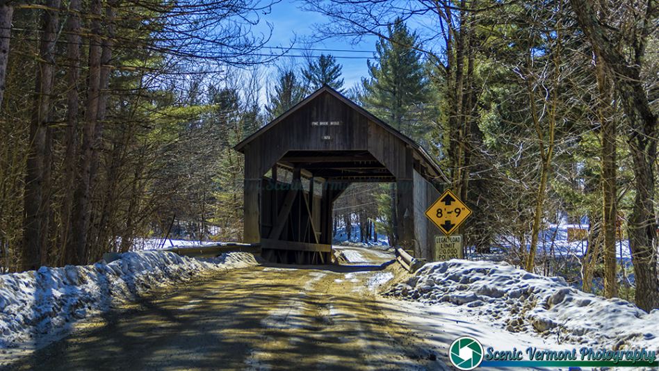
Pine Brook Covered Bridge
Also known as Wilder Covered Bridge
Pine Brook Covered Bridge carries North Road across Pine Brook in Waitsfield. It offers a different setting from Great Eddy’s village crossing and can be considered for the same valley outing.
Location & approach
Research North Road near Meadow Road in Waitsfield. Check current directions and find a permitted stopping place without obstructing the crossing.
BARRE TOWN
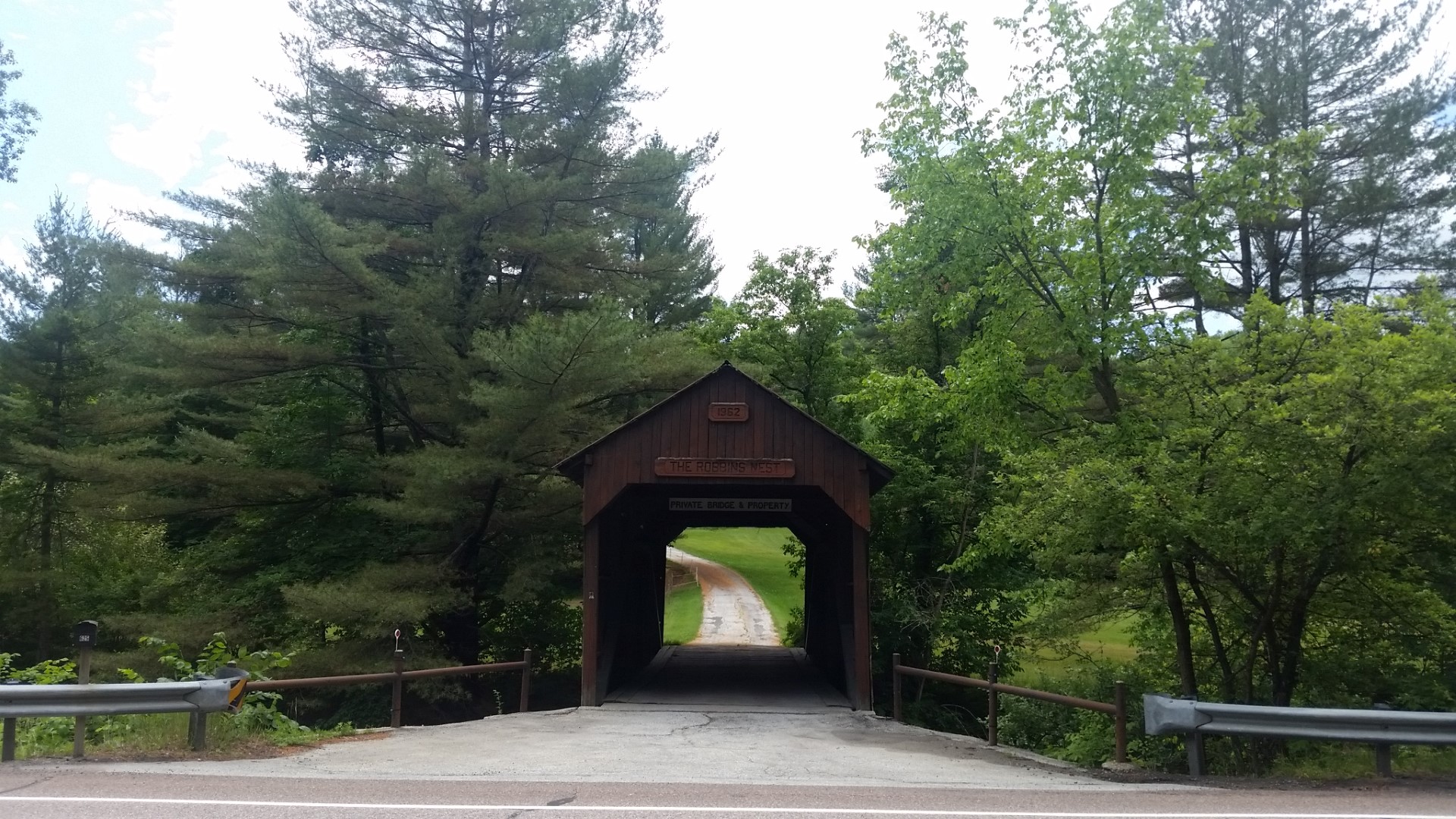
Robbins Nest Covered Bridge
A privately owned crossing
Robbins Nest Covered Bridge crosses the Jail Branch of the Winooski River off US Route 302 in Barre Town. Built as a later covered bridge, it serves private property rather than a public visitor route.
Location & approach
Look for the location northwest of East Barre along US Route 302 when researching the bridge. Obtain permission before entering its private drive or crossing the bridge.
NORTHFIELD
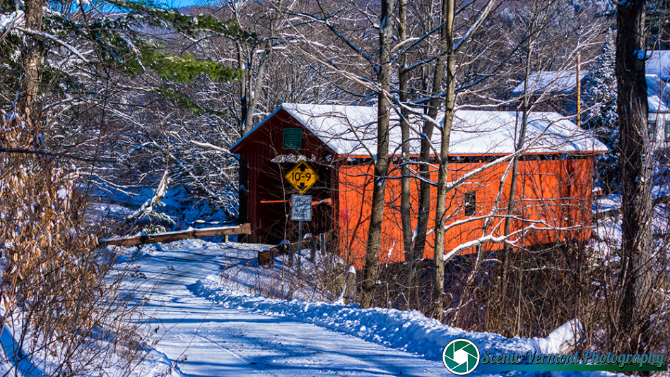
Slaughter House Covered Bridge
Also spelled Slaughterhouse Covered Bridge
Slaughter House Covered Bridge carries Slaughterhouse Road across the Dog River in Northfield. Its red-sided crossing adds another bridge to explore beyond the Cox Brook Road group.
Location & approach
Look for Slaughterhouse Road off VT Route 12 south of Northfield Falls. Follow current signs and keep private access points clear.
NORTHFIELD
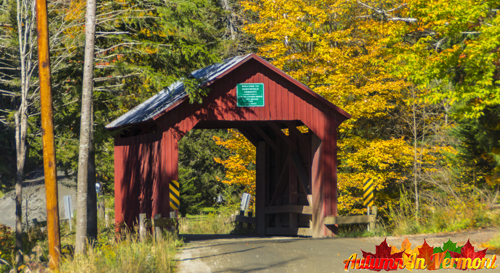
Stony Brook Covered Bridge
Also known as Moseley Covered Bridge
Stony Brook Covered Bridge carries Stony Brook Road across its namesake stream in southwestern Northfield. It is a separate outing from the closely grouped bridges at Northfield Falls.
Location & approach
Research Stony Brook Road off VT Route 12A. Confirm the final approach and road conditions rather than relying on older mileage directions.
NORTHFIELD FALLS
Upper Cox Brook Covered Bridge
The third bridge along Cox Brook Road
Upper Cox Brook Covered Bridge crosses Cox Brook west of the Lower Cox Brook crossing. Together with Northfield Falls Bridge, the three make this road a useful starting point for researching Northfield’s covered bridges.
Location & approach
Follow Cox Brook Road west from Northfield Falls. Check Northfield’s current notices and bridge-planning information before choosing your route.
WARREN
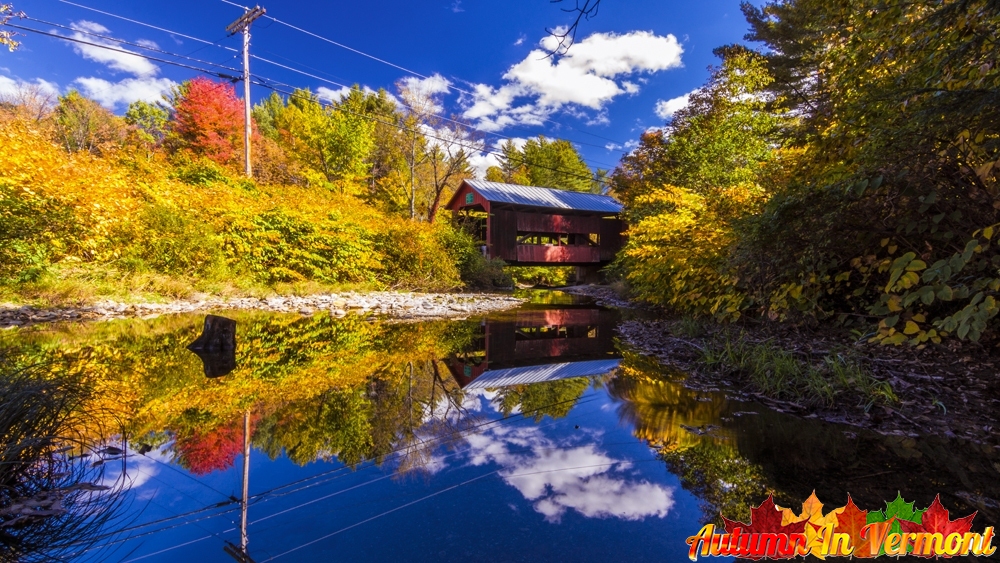
Warren Covered Bridge
A Mad River village crossing
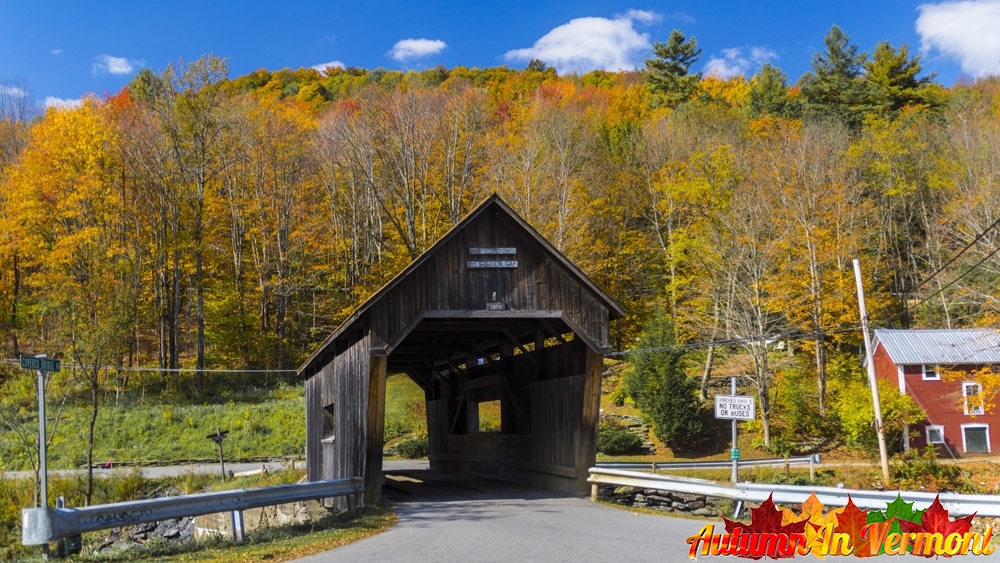
Warren Covered Bridge crosses the Mad River on Covered Bridge Road near Main Street. Consider it with Waitsfield’s Great Eddy and Pine Brook bridges for a Mad River Valley drive.
Location & approach
Research Covered Bridge Road off Main Street in Warren village, reached from VT Route 100. Confirm current navigation and posted vehicle limits.
MAKE A DAY OF IT
Build a bridge route at your own pace
Northfield & Northfield Falls
Research the three Cox Brook Road bridges together, then consider Slaughter House and Stony Brook as additional stops. Check town notices before traveling.
Waitsfield & Warren
Compare Great Eddy, Pine Brook and Warren for a Mad River Valley outing. Leave time for village stops and confirm parking at each location.
East Montpelier, Marshfield & Cabot
Consider Coburn and Martin along the Route 2 corridor, then decide whether to add Cabot’s A.M. Foster bridge. Confirm permission separately for private-property visits.
Barre Town
Treat Robbins Nest as a private-property listing. Obtain permission before using the drive or crossing; a photograph or map marker does not establish public access.
Enjoy the view. Respect the crossing.
Use permitted parking and keep roads, bridge entrances and private driveways clear. Photograph from safe places, respect nearby homes and follow all closure, clearance and weight signs.
Check road conditions after heavy rain and use a flexible itinerary during repair work. Photographs show the bridges when photographed; signs or road conditions in older images may have changed.
Washington County covered-bridge questions
How many bridges are featured in this guide?
This page features 12 covered-bridge listings, including historic crossings, later replicas and private bridges. It does not claim to inventory every covered structure in the county.
Which bridges are on Cox Brook Road?
Northfield Falls, Lower Cox Brook and Upper Cox Brook are the three crossings on Cox Brook Road in Northfield. Northfield Falls crosses the Dog River; the other two cross Cox Brook.
Are Great Eddy and Big Eddy the same bridge?
Yes. Great Eddy is also called Big Eddy or Waitsfield Covered Bridge. It is the Bridge Street crossing of the Mad River in Waitsfield.
Is A.M. Foster a nineteenth-century bridge?
No. A.M. Foster is a later replica built in the late 1980s. Its design draws on Martin Covered Bridge in Marshfield.
Are all the bridges open to the public?
No public access should be assumed. A.M. Foster and Robbins Nest involve private property; confirm permission before entering. Check town or park information and signs for other locations.
Where is Martin Covered Bridge?
Martin is at the town’s Martin Covered Bridge Park in Marshfield, with parking off US Route 2. Confirm bridge and trail access with the town before your visit.
Where can I find a covered bridges map?
Use the statewide map linked throughout this guide to compare locations, then confirm your route and current access with local sources.
KEEP EXPLORING
Find another Vermont crossing
Explore another county, follow a scenic byway and discover more bridge stories along your route.