
Vermont's Covered Bridges - Orange County
ORANGE COUNTY · VERMONT
Covered Bridges in Orange County, Vermont
Explore 11 covered bridges in Chelsea, Randolph, Thetford and Tunbridge, with photos and location notes to help plan your next Vermont drive.
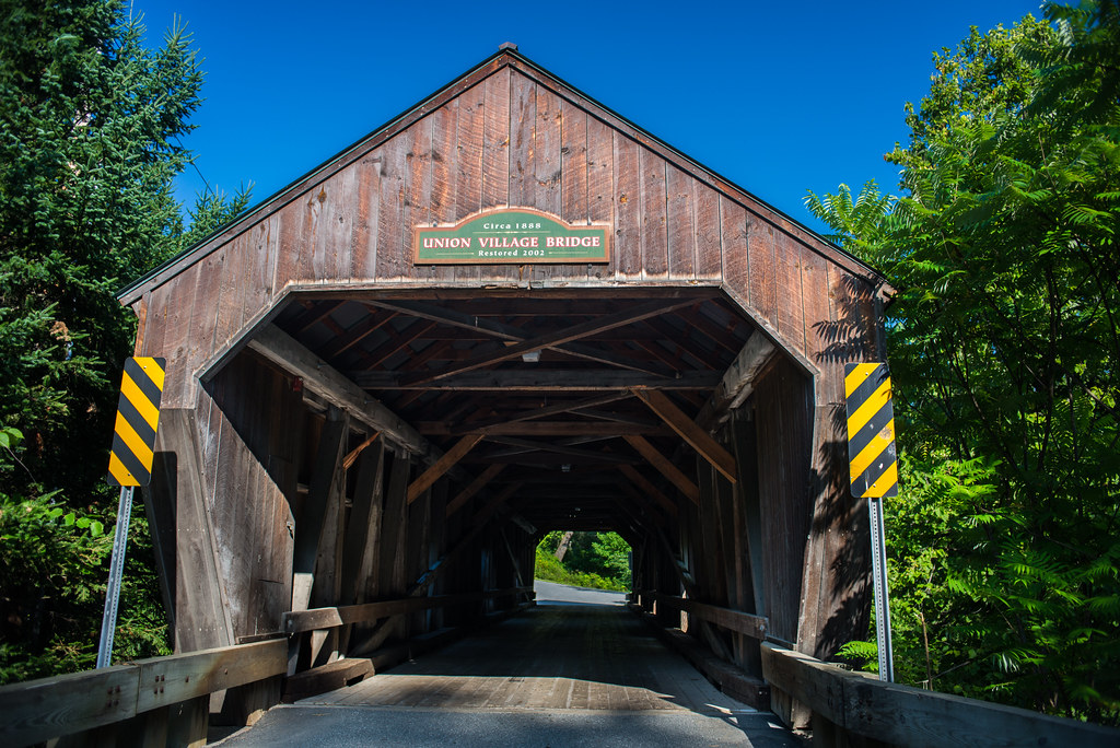
COUNTRY ROADS. RIVER VIEWS. TIMELESS VERMONT CROSSINGS.
Home / Covered Bridges / Orange County
FIND YOUR NEXT CROSSING
Explore Orange County’s covered bridges
Follow the White River’s branches through Chelsea, Randolph and Tunbridge, or plan a separate outing to the Ompompanoosuc River crossings in Thetford. This guide brings together 11 bridge listings, their photographs and road names in one place.
Choose a bridge below to jump to its details. Use the statewide map to compare locations, then check current town information before traveling.
CHELSEA
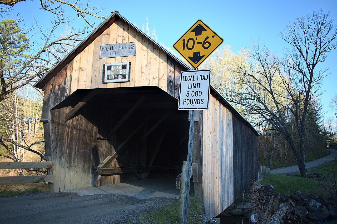
Moxley Covered Bridge
A First Branch crossing in southern Chelsea
Moxley Covered Bridge carries Moxley Road across the First Branch of the White River. Its Chelsea location makes it a natural addition to a bridge outing along the Route 110 corridor.
Location & approach
Look for Moxley Road off VT Route 110 in southern Chelsea. Use the bridge name to confirm the final approach.
RANDOLPH
Kingsbury Covered Bridge
Also known as Hyde Covered Bridge
Kingsbury Covered Bridge crosses the Second Branch of the White River on Kingsbury Road. Its alternate name, Hyde Covered Bridge, can be confusing because nearby Gifford Covered Bridge is on Hyde Road.
Location & approach
Look for Kingsbury Road off VT Route 14, north of East Bethel. Search by the bridge name and town rather than the alternate name alone.
RANDOLPH
Gifford Covered Bridge
Also known as C.K. Smith Covered Bridge
Gifford Covered Bridge carries Hyde Road across the Second Branch of the White River. Pair it with Kingsbury and Braley when planning a Randolph-area bridge drive.
Location & approach
Look for Hyde Road off VT Route 14, south of the VT Route 66 junction. This is a different crossing from Kingsbury Bridge.
RANDOLPH
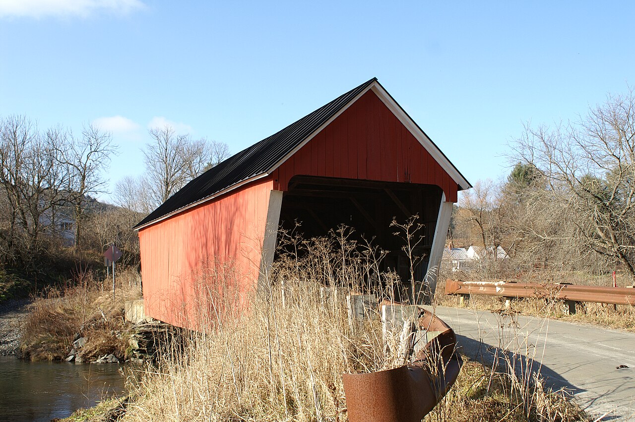
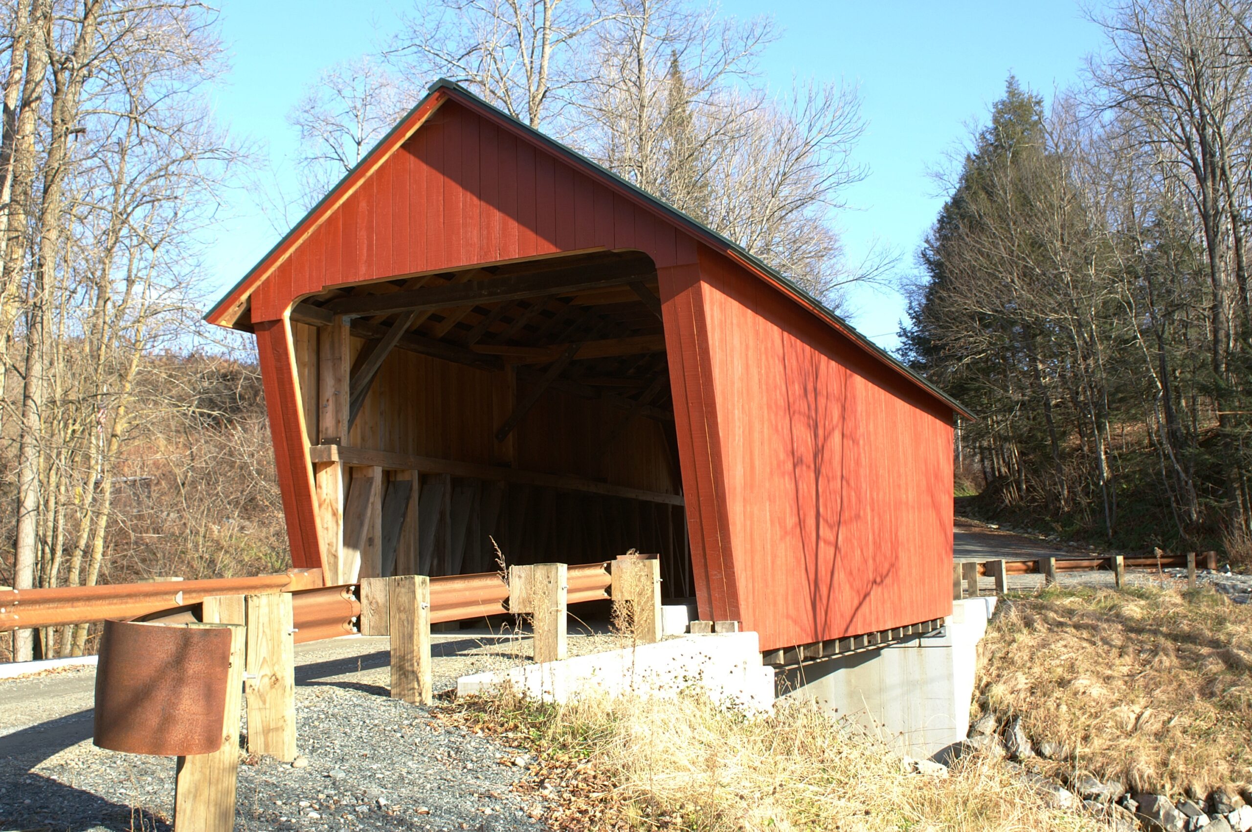
Braley Covered Bridge
Also known as Johnson or Upper Blaisdell Covered Bridge
Braley Covered Bridge spans the Second Branch of the White River on Braley Covered Bridge Road. Its alternate names offer useful search terms when exploring local bridge history.
Location & approach
Look for Braley Covered Bridge Road off VT Route 14 south of East Randolph. Confirm the road name in current navigation before setting out.
THETFORD
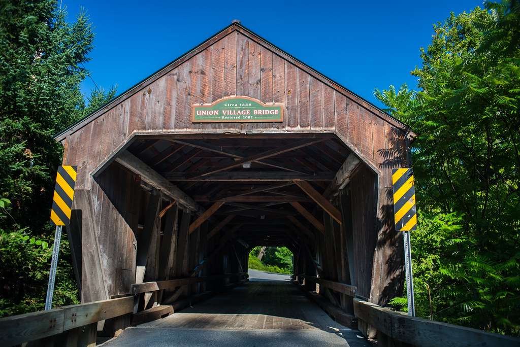
Union Village Covered Bridge
An Academy Road landmark
Union Village Covered Bridge carries Academy Road across the Ompompanoosuc River in Thetford’s Union Village. It is one of two Thetford crossings featured in this guide.
Location & approach
Approach Union Village via VT Route 132 and look for Academy Road. Check the bridge destination and available parking before your visit.
THETFORD
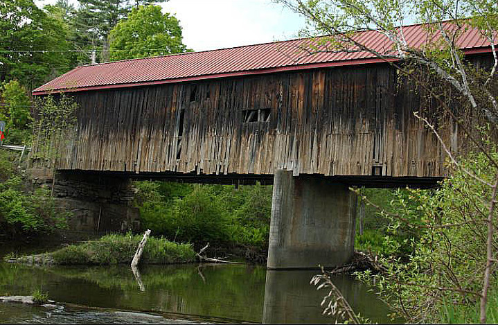
Thetford Center Covered Bridge
A Tucker Hill Road crossing
Thetford Center Covered Bridge crosses the Ompompanoosuc River on Tucker Hill Road. Consider it alongside Union Village for a Thetford-focused outing.
Location & approach
Look for Tucker Hill Road near VT Route 113 at Thetford Center. Confirm the final approach and follow current signs.
TUNBRIDGE
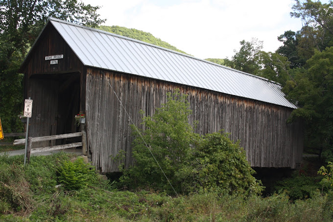
Howe Covered Bridge
A bridge near the southern end of Tunbridge
Howe Covered Bridge stands on Belknap Brook Road just east of VT Route 110. It is one of the Tunbridge crossings that follow the First Branch of the White River through town.
Location & approach
Look for Belknap Brook Road off VT Route 110 in southern Tunbridge. Do not confuse this bridge’s road with Howe Lane, the location of Cilley Bridge.
TUNBRIDGE
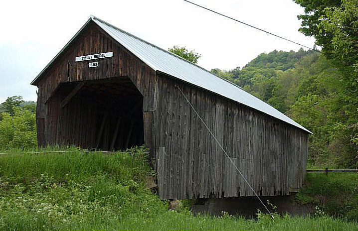
Cilley Covered Bridge
A Howe Lane crossing
Cilley Covered Bridge carries Howe Lane across the First Branch of the White River south of Tunbridge village. The road name makes it especially helpful to navigate using the bridge’s full name.
Location & approach
Look for Howe Lane off VT Route 110 south of Tunbridge village. Keep the bridge approach and neighboring access points clear.
TUNBRIDGE
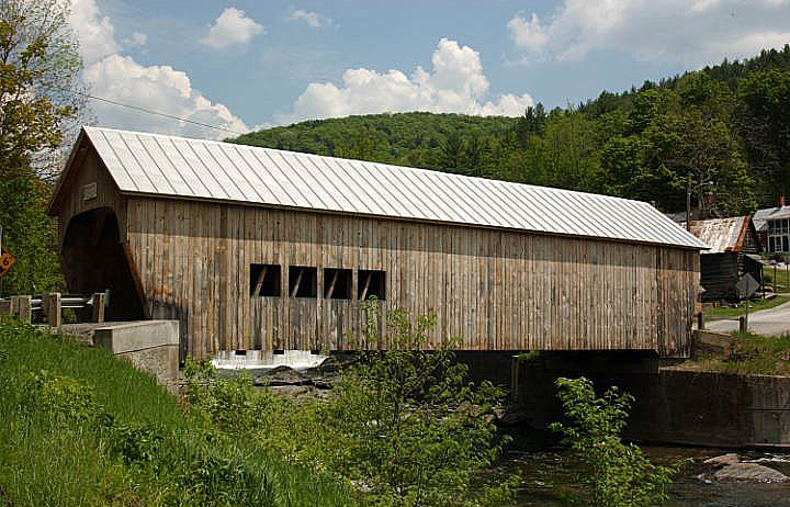
Mill Covered Bridge
A historic crossing rebuilt in 2000
The present Mill Covered Bridge was built in 2000 to replace the earlier bridge lost to ice damage. It carries Spring Road across the First Branch of the White River, continuing the covered-crossing tradition at this village site.
Location & approach
Look for Spring Road west of VT Route 110 in Tunbridge village. Use Tunbridge with the bridge name to distinguish it from other Vermont Mill bridges.
TUNBRIDGE
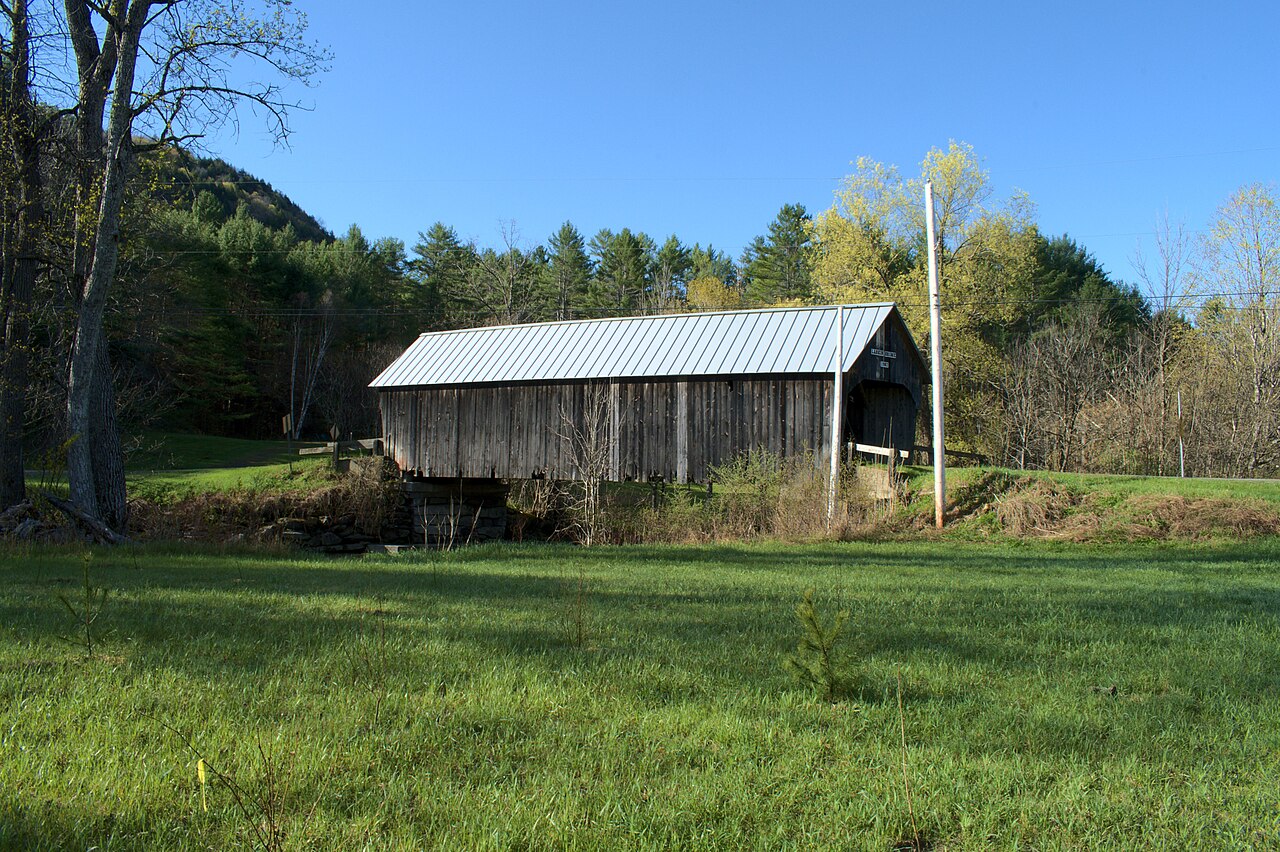
Larkin Covered Bridge
A crossing in northern Tunbridge
Larkin Covered Bridge spans the First Branch of the White River on Larkin Road. It is another stop to consider while exploring the northern part of Tunbridge along Route 110.
Location & approach
Look for Larkin Road off VT Route 110 north of Tunbridge village. Check current road information when combining it with other crossings.
TUNBRIDGE
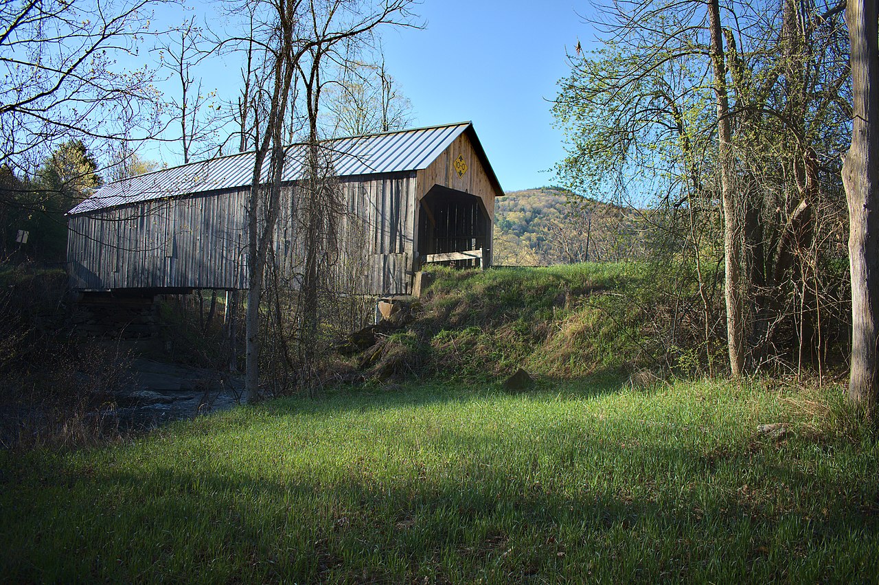
Flint Covered Bridge
Near the Chelsea town line
Flint Covered Bridge carries Bicknell Hill Road across the First Branch of the White River in northern Tunbridge. Its location near Chelsea makes it a useful companion to the Moxley Bridge listing.
Location & approach
Look for Bicknell Hill Road off VT Route 110 just south of the Chelsea–Tunbridge town line. Confirm a permitted place to stop before leaving your vehicle.
MAKE A DAY OF IT
Plan your drive by area
Chelsea & Tunbridge
Explore the Route 110 corridor with Moxley in Chelsea and Howe, Cilley, Mill, Larkin and Flint in Tunbridge. Select a few stops and leave time for the villages along the way.
Randolph
Group Kingsbury, Gifford and Braley around the Route 14 corridor. Keep their road names handy: Kingsbury Road, Hyde Road and Braley Covered Bridge Road.
Thetford
Plan Union Village on Academy Road and Thetford Center on Tucker Hill Road as a Thetford-area outing. Compare the approaches before choosing your route.
Enjoy the view. Respect the crossing.
Use permitted parking and photograph from safe places without blocking traffic, bridge entrances or private driveways. Respect nearby homes and stay out of closed areas.
Access can change with weather and repairs. Follow posted closure, clearance and weight signs, and check with the relevant town before planning a vehicle crossing. These location notes are a planning guide, not a live road-status report.
Orange County covered-bridge questions
How many Orange County covered bridges are in this guide?
This guide features 11 bridge listings in Chelsea, Randolph, Thetford and Tunbridge. It is a selection for trip planning, rather than an inventory of every covered structure in the county.
Which covered bridges are featured in Tunbridge?
The Tunbridge listings are Howe, Cilley, Mill, Larkin and Flint. They follow the First Branch of the White River near the Route 110 corridor.
Is the Mill Covered Bridge the original historic bridge?
No. The present bridge on Spring Road in Tunbridge was built in 2000 to replace the earlier bridge lost to ice damage.
Are Kingsbury and Gifford the same bridge?
No. Kingsbury, also called Hyde Covered Bridge, is on Kingsbury Road. Gifford, also called C.K. Smith Covered Bridge, is on Hyde Road. Both are in Randolph.
Can I drive across these covered bridges?
Check each bridge’s current signs and town information before crossing. Vehicle limits, temporary closures and road conditions may affect access.
Where can I find a map?
Use the covered bridges map linked on this page to compare locations. Confirm your final route and local access before traveling.
KEEP EXPLORING
Find your next Vermont bridge
Discover another county, compare stops on the map and add a scenic detour to your Vermont trip.