
Vermont's Covered Bridges - Caledonia County
CALEDONIA COUNTY · VERMONT
Covered Bridges in Caledonia County
Discover five covered-bridge landmarks in Danville and Lyndon, with original photographs, location notes and ideas for a Northeast Kingdom outing.
QUIET ROADS. RIVER CROSSINGS. NORTHEAST KINGDOM STORIES.
Home / Covered Bridges / Caledonia County
CHOOSE YOUR NEXT STOP
Explore bridges around Danville and Lyndon
This guide preserves the five listings from the original Caledonia County page: Greenbanks Hollow, School House, Chamberlin Mill, Miller’s Run and Randall/Burrington. It is a selection of local crossings, not a complete county inventory.
Use the photos and location notes to choose your stops, then check current directions, road conditions and visitor access. A bypassed historic bridge needs different planning from a bridge that carries road traffic.
DANVILLE
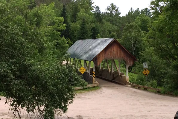
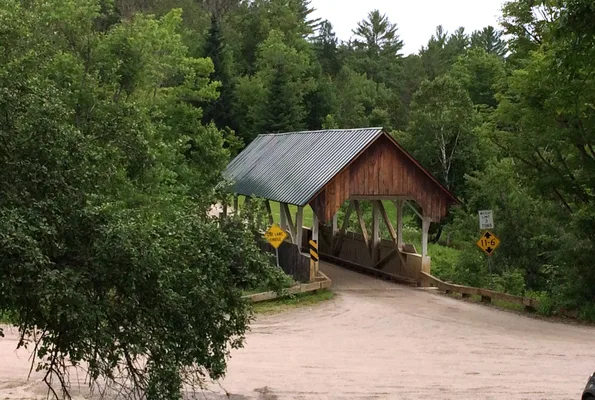
Greenbanks Hollow Covered Bridge
A crossing over Joes Brook
Greenbanks Hollow Covered Bridge carries Greenbanks Hollow Road across Joes Brook in southern Danville. Its rural setting provides a starting point for exploring the county beyond the Lyndon-area bridges.
Location & approach
The original guide approaches from Danville via Brainard Street and Greenbanks Hollow Road. Use current directions to the named bridge and check local signs before approaching.
Before you visit: Treat the crossing as a road, keep entrances clear and photograph only from a permitted location.
LYNDON
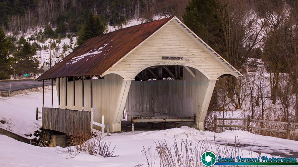
School House Covered Bridge
Also known as Old Schoolhouse Bridge
The Old Schoolhouse Bridge spans the South Wheelock Branch of the Passumpsic River near South Wheelock Road. It formerly carried the road and is now a historic crossing to research separately from the active roadway.
Location & approach
Look just south of South Wheelock Road near its US Route 5 approach, south of Lyndonville. The original guide identifies the old span on the south side of the road.
Before you visit: Do not plan to drive through the old bridge. Confirm current pedestrian access and parking before visiting.
LYNDON
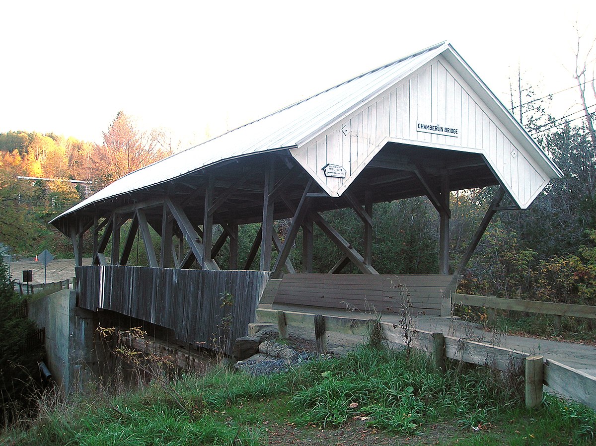
Chamberlin Mill Covered Bridge
Also known as Chamberlin or Whitcomb Covered Bridge
Chamberlin Mill Covered Bridge crosses the South Wheelock Branch of the Passumpsic River. The bridge and approach road also appear with the spelling Chamberlain in some local references.
Location & approach
Research Chamberlin/Chamberlain Bridge Road off South Wheelock Road, southwest of Lyndonville. Use the bridge name to confirm the destination rather than relying only on a spelling variation.
Before you visit: Follow posted vehicle restrictions and keep the road and neighboring driveways clear.
LYNDON
Miller’s Run Covered Bridge
Also known as Bradley Covered Bridge
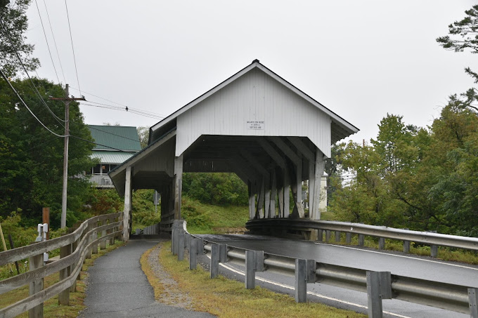
Miller’s Run Covered Bridge crosses Miller Run in Lyndon and is associated with the VT Route 122/Center Street approach. Town records also identify it as Bradley Covered Bridge.
Location & approach
Follow current directions for Miller’s Run Covered Bridge on VT Route 122 northwest of Lyndonville. The original guide describes a pedestrian walkway alongside the crossing.
Before you visit: Check current signs and vehicle clearance before approaching. Use only open, permitted pedestrian areas for viewing and photographs.
LYNDON
Randall / Burrington Covered Bridge
A bypassed historic crossing
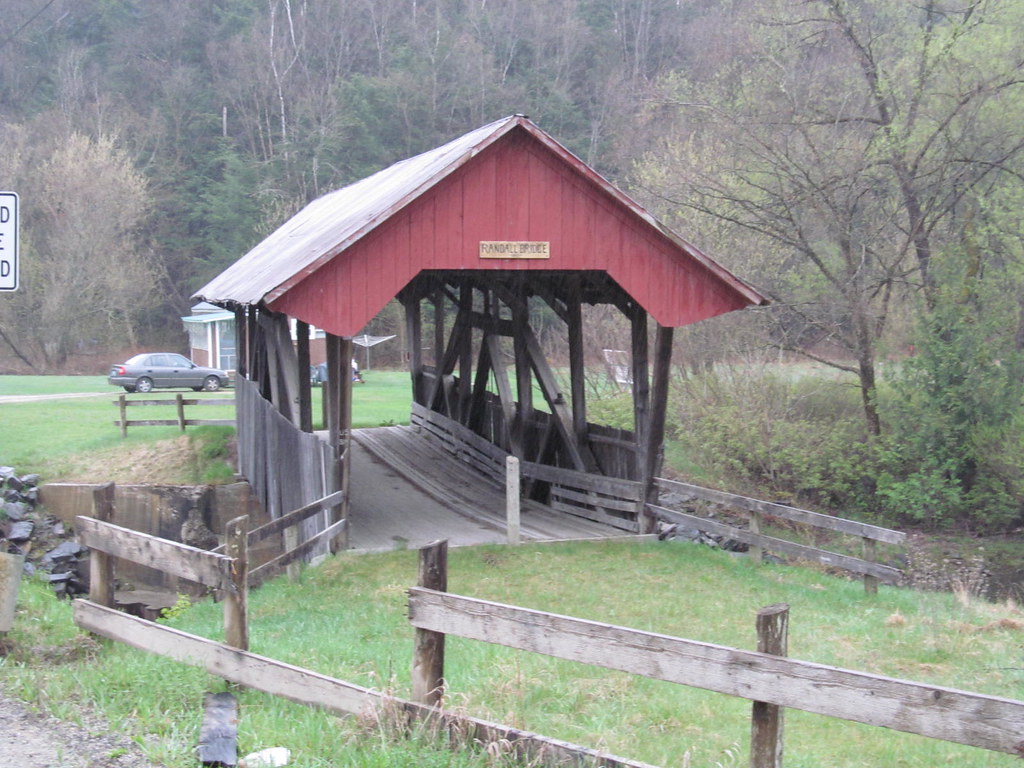
Randall Covered Bridge, also known as Burrington Covered Bridge, formerly carried Burrington Bridge Road across the Passumpsic River. A newer crossing bypasses the historic span.
Location & approach
Research Burrington Bridge Road off VT Route 114 northeast of Lyndonville. Locate the old span separately from the current road bridge when planning your visit.
Before you visit: Do not treat the historic span as a driving route. Confirm current public access and parking with the Town of Lyndon before entering the site.
PLAN A MANAGEABLE OUTING
Give each area time to explore
Start with Danville
Make Greenbanks Hollow your focus for a Danville-area outing. Leave room for a village stop and check the rural approach before setting off.
Group the Lyndon bridges
Research School House, Chamberlin Mill, Miller’s Run and Randall/Burrington together. Compare their approaches and access arrangements before deciding how many to include.
ENJOY THE VIEW. RESPECT THE CROSSING.
Tips for visiting covered bridges
Use permitted parking, keep bridge entrances and private driveways clear, and stay out of traffic when taking photographs. Do not climb on structural timbers or enter closed areas.
Follow posted vehicle restrictions and closures. For a bypassed bridge, confirm whether pedestrian access is allowed rather than assuming the old span is open. Allow extra time if weather or road work changes your route.
Caledonia County bridge questions
Which Caledonia County bridges are featured here?
This guide includes Greenbanks Hollow in Danville and School House, Chamberlin Mill, Miller’s Run and Randall/Burrington in Lyndon. These are the original page’s five selections, not every bridge in the county.
Is Miller’s Run also called Bradley Covered Bridge?
Yes. Town records use Bradley Covered Bridge as another name for Miller’s Run. Use both names when researching its history and location.
Can I drive through School House or Randall/Burrington?
Do not plan either historic span as a driving crossing. Both are bypassed bridges; confirm current pedestrian access and parking before visiting.
Are Chamberlin and Chamberlain different bridges?
Those spelling variants appear in references to the Chamberlin Mill bridge and its approach road. Confirm the location off South Wheelock Road rather than relying only on the spelling.
Where can I find more covered bridges nearby?
Use the statewide map, the county directory and the Vermont Covered Bridge Society’s Caledonia resources. Follow current town information for access and road updates.
MORE VERMONT TO DISCOVER
Find another bridge along your route
Continue exploring with the statewide map, county directory and background guide to Vermont’s covered bridges.