
Vermont's Covered Bridges - Addison County
ADDISON COUNTY · VERMONT
Covered Bridges in Addison County
Explore four covered-bridge landmarks, from a former railroad crossing in East Shoreham to the timber spans around Middlebury.
COUNTRY ROADS. HISTORIC TIMBERS. A SLOWER DAY OUT.
Home / Covered Bridges / Addison County
CHOOSE YOUR NEXT CROSSING
Discover Addison County’s covered bridges
This guide brings together the four bridges featured on the original Addison County page: Spade Farm, Halpin, East Shoreham and Pulp Mill. Each offers a different glimpse of the county’s bridge heritage, from a relocated farm bridge to a former railroad span.
Use the location notes to research your route, then check current local information before traveling. Some crossings serve roads or farm access, while others are historic sites or private property. A listing is not confirmation of public entry or vehicle access.
FERRISBURGH
Spade Farm Covered Bridge
Also known as Old Hollow Covered Bridge
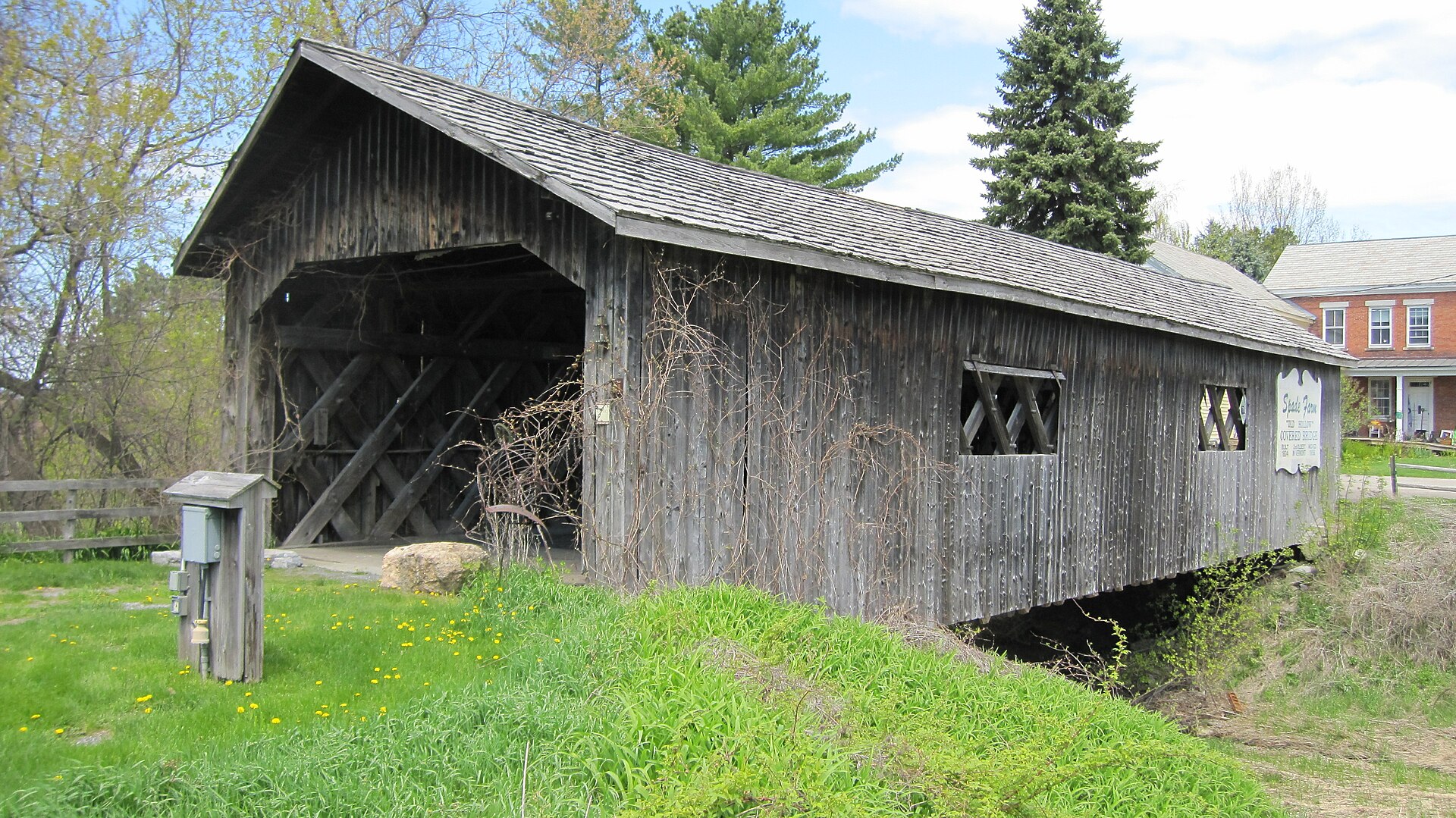
The Spade Farm bridge stands off US Route 7 in Ferrisburgh, crossing a small drainage channel. The original page also refers to it as Old Hollow and Old Covered Bridge Farm.
Location & approach
The original guide places the bridge on the west side of US Route 7, about 3.9 miles north of the VT Route 22A junction. Use that as an orientation point, not a confirmed visitor entrance.
Before you visit: The Vermont Covered Bridge Society identifies this bridge as privately owned. Confirm permission before entering the property; do not treat it as a public road crossing.
MIDDLEBURY AREA
Halpin Covered Bridge
A crossing above the Muddy Branch
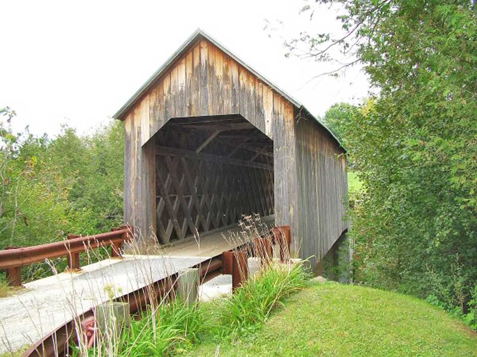
Halpin Covered Bridge crosses the Muddy Branch of the New Haven River. Its elevated setting and rural surroundings make it a distinctive stop to research in the Middlebury area.
Location & approach
Research Halpin Covered Bridge Road via Halpin Road. The original approach uses Washington Street from Middlebury and identifies the bridge road as a dead end. Check current directions and turning arrangements.
Before you visit: The original guide describes the road as leading to a farmyard. Keep farm access and private driveways clear, follow local signs, and confirm an appropriate place to stop before visiting.
EAST SHOREHAM
East Shoreham Covered Railroad Bridge
A reminder of Vermont’s rail history
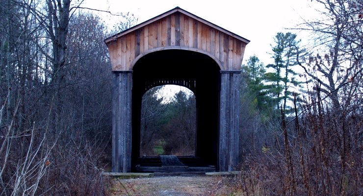
Built in 1897 by the Rutland Railroad Company, this covered railroad bridge uses a Howe truss. Vermont’s historic-sites records identify it as a state-owned bridge and record its closure to rail service in 1923.
Location & approach
The original route follows Shoreham–Whiting Road and Richville Road to Shoreham Depot Road. It describes a fishing-access parking area opposite Dame Road and a short walk west; verify that this approach is currently open and permitted.
Before you visit: Plan this as a historic bridge visit rather than a driving crossing. Confirm the current pedestrian approach, parking and access conditions before setting out.
MIDDLEBURY / WEYBRIDGE
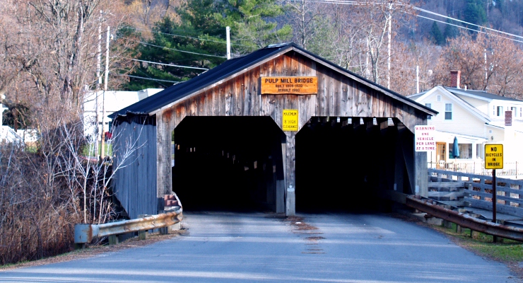
Pulp Mill Covered Bridge
Also known as Paper Mill Covered Bridge
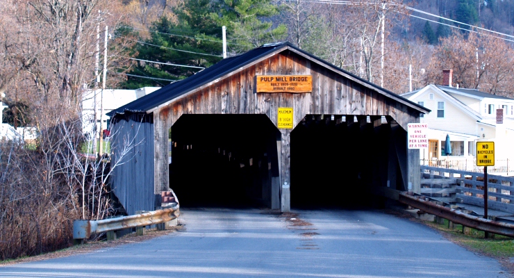
Pulp Mill Covered Bridge spans Otter Creek between Middlebury and Weybridge. Its two-lane, “double-barrel” form distinguishes it from the single-lane crossings many visitors associate with Vermont.
Location & approach
Look for Pulp Mill Bridge Road near the Seymour Street side of Middlebury and the Weybridge Street/VT Route 23 approach. Use current navigation and posted signs for your final route.
Before you visit: Treat the bridge and its approaches as a roadway. Follow posted restrictions and take photographs only from a safe, permitted location that does not obstruct traffic.
MAKE THE MOST OF YOUR DRIVE
Plan a thoughtful bridge outing
Choose a manageable area
Start with one part of the county rather than trying to fit every stop into a tight schedule. Leave time for a village visit, a meal and changing weather.
Check access first
Use the map and background links for research, then confirm local road conditions and restrictions. Private ownership, maintenance work or a closed approach may change your plans.
Respect the crossing
Use permitted parking, keep entrances clear and stay out of traffic when taking photographs. Do not climb on timbers or enter closed areas.
Addison County covered bridges: questions
Which Addison County covered bridges are included here?
This guide covers Spade Farm/Old Hollow, Halpin, East Shoreham Covered Railroad Bridge and Pulp Mill. It preserves the four listings from the original page and is not a complete inventory of every covered structure in the county.
Is Spade Farm Covered Bridge open to the public?
It is identified as privately owned by the Vermont Covered Bridge Society. Confirm permission and current access with the owner before entering the property.
Can I drive over the East Shoreham railroad bridge?
Do not plan it as a road crossing. It is a former railroad bridge; check current pedestrian access and parking information before visiting.
Where is Pulp Mill Covered Bridge?
It spans Otter Creek between Middlebury and Weybridge. Research the Pulp Mill Bridge Road approaches and follow current local directions and signs.
Where can I find more Vermont covered bridges?
Use the statewide covered-bridges map and the county directory linked on this page. The main covered-bridges guide provides more background and visiting ideas.
KEEP EXPLORING VERMONT
Find another bridge along the way
Continue with another county or build a scenic drive around the places you most want to explore.