
Vermont's Green Mountains Most Scenic Hikes
Hiking Trails in Vermont
Vermont offers a wide range of hiking trails for all skill levels, from easy strolls to challenging treks. Whether you’re a novice hiker or an experienced backpacker, there is something for everyone in this outdoor paradise. Here are some of the top hiking trails in Vermont that should be on every nature lover’s bucket list:Mount Mansfield
Location: Stowe / Underhill
Distance: 5–8 miles depending on route
Difficulty: Moderate to Strenuous
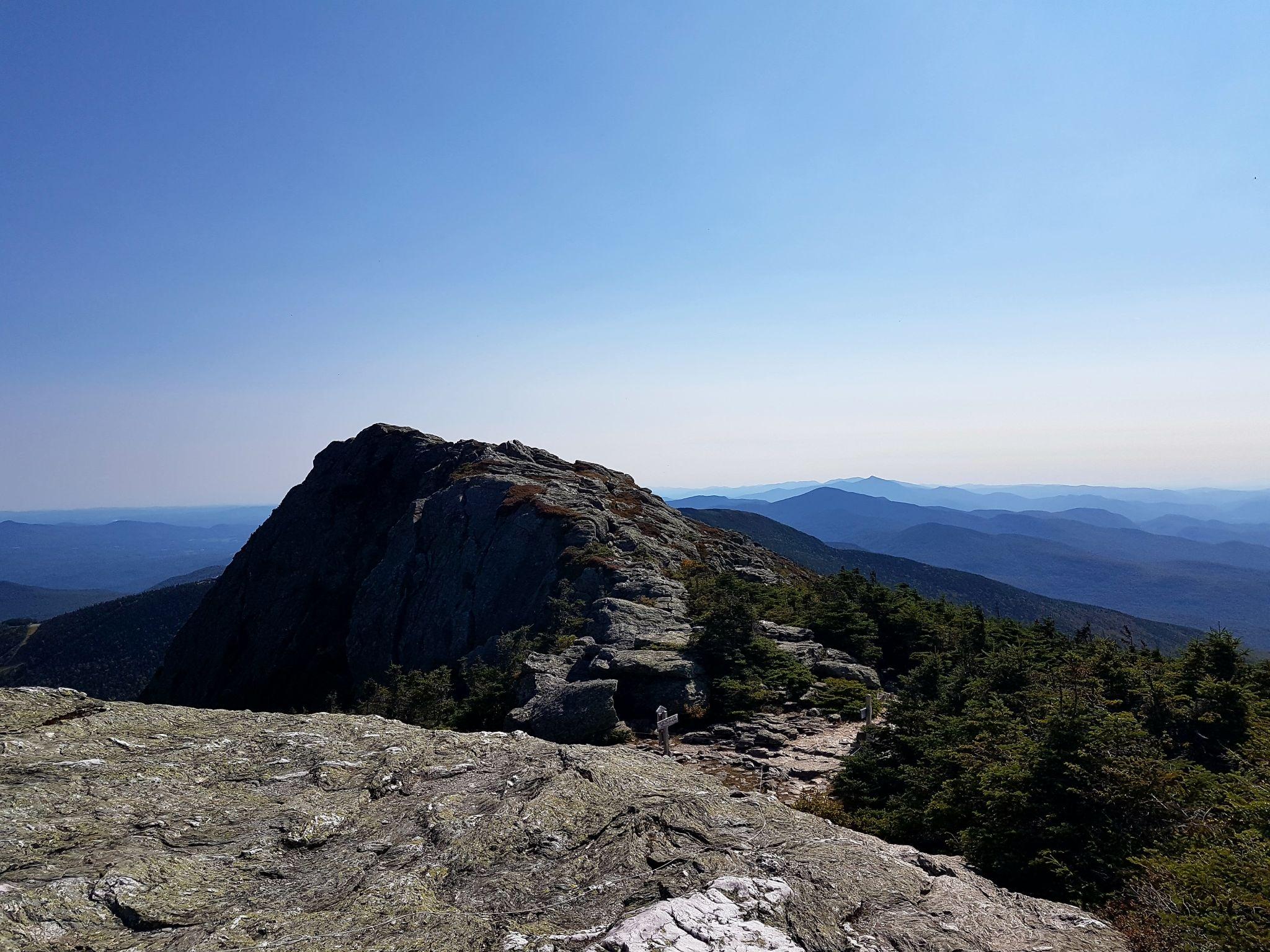
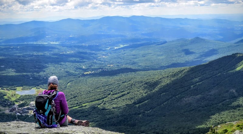
Mount Mansfield is the highest mountain in Vermont and the tallest peak in the Green Mountains, rising to about 4,393 feet (1,339 meters). Its distinctive ridgeline resembles a human face when viewed from a distance, making it one of the state’s most recognizable natural landmarks and a centerpiece of outdoor recreation in northern Vermont.
Landscape and Geography
The mountain straddles the area between the towns of Stowe and Underhill and consists of several named summit features, including the Forehead, Nose, Lips, Adam’s Apple, and the Chin, which is the highest point. The profile-like shape has made Mount Mansfield an iconic symbol of Vermont’s mountain landscape.
Highlights
- Vermont’s highest peak (4,395 feet)
- Dramatic alpine ridgeline known as “The Chin”
- Views stretching across Vermont, New York, New Hampshire, and Canada
- Rare alpine tundra ecosystem
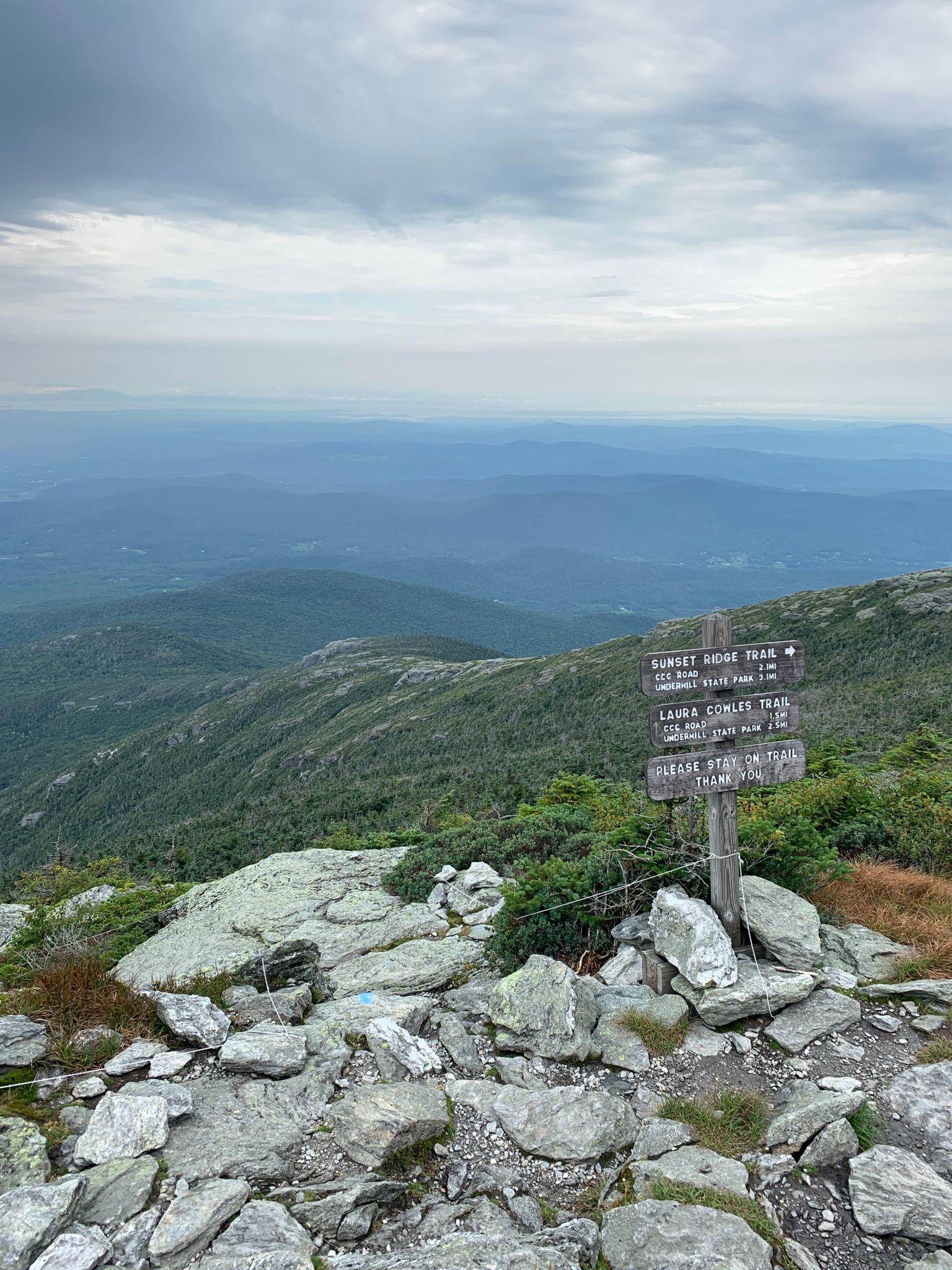
Popular routes include the Sunset Ridge Trail and Long Trail approaches. Many hikers consider the ridge walk among the most spectacular mountain experiences in New England.
Key Hikes & Routes
- Sunset Ridge Loop: (Challenging) 6 to 7.6 miles round-trip starting from Underhill State Park. Ascend the steep, technical Maple Ridge Trail (requires minor bouldering/leaping) or Laura Cowles, and descend via Sunset Ridge. [1, 2, 3]
- The Long Trail (Stowe Side): (Difficult) 5.3-mile out-and-back beginning on Route 108 near Barnes Camp. Climbs past Taft Lodge (the oldest shelter on the Long Trail) before cresting “The Chin”. [1, 2]
Camel’s Hump
Location: Duxbury / Huntington
Distance: 4.7–7 miles round trip
Difficulty: Moderate to Hard
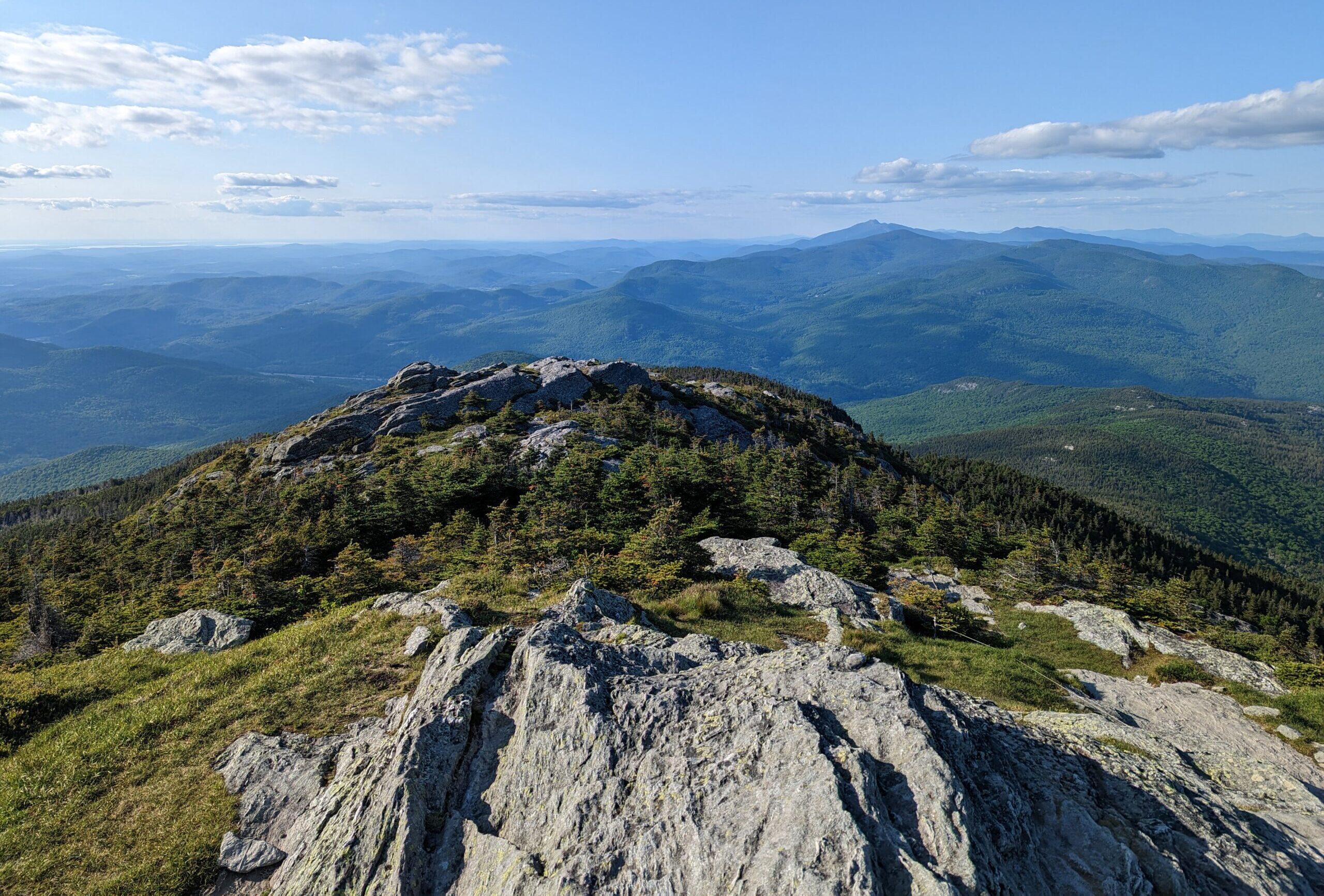
Camel’s Hump is one of Vermont’s most recognizable mountains, located in the Green Mountains between Huntington and Duxbury. Rising to 4,083 feet, it is tied for Vermont’s third-highest peak and is famous for its distinctive double-humped silhouette, which appears on Vermont symbols including the state quarter and coat of arms.
Landscape and Geography
Camel’s Hump stands out more for its shape than its height. Glacial activity sculpted the mountain into its iconic profile, creating two prominent humps separated by a saddle. The summit is largely above treeline and supports rare alpine tundra vegetation, a habitat found on only a handful of New England peaks.
Highlights
- Vermont’s most recognizable mountain
- Highest undeveloped peak in the state
- Exposed alpine summit with 360-degree views
- Iconic profile featured on Vermont’s state quarter
The summit panorama includes the Adirondacks, White Mountains, Lake Champlain, and neighboring Green Mountain peaks. The Monroe and Burrows Trails are the most popular routes.
Hiking and Recreation
The mountain is the centerpiece of Camel’s Hump State Park, a protected area with an extensive trail network. Popular routes such as the Monroe, Burrows, and Long Trails lead to the summit, where hikers are rewarded with panoramic views across Vermont and, on clear days, into New York’s Adirondack Mountains. Trail difficulty ranges from accessible viewpoints to strenuous summit climbs.
Mount Abraham
Location: Lincoln
Distance: 5–7 miles
Difficulty: Moderate
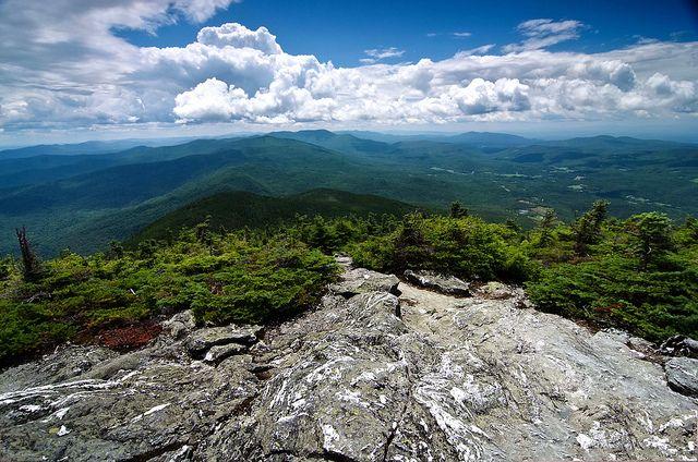
Mount Abraham is a prominent summit in Vermont’s Green Mountains and one of the state’s five peaks exceeding 4,000 feet in elevation. Known locally as “Mount Abe,” it is the highest point in Addison County and ranks among Vermont’s most celebrated hiking destinations because of its open summit, rare alpine vegetation, and sweeping panoramic views.
Landscape and Geography
Mount Abraham rises to approximately 4,006 feet (1,221 m) within the Green Mountain National Forest, near the towns of Lincoln and Warren. The mountain is part of Vermont’s Presidential Range, a group of neighboring peaks that includes Lincoln Peak, Mount Ellen, and other high summits along the central Green Mountains. Its exposed upper slopes support a fragile alpine tundra ecosystem that is uncommon in Vermont.
Highlights
- Open alpine summit
- Extensive views of the Green Mountains
- Excellent wildflower displays in summer
- Less crowded than Mansfield or Camel’s Hump
On clear days, hikers can see Lake Champlain and the Adirondack Mountains.
Hiking Experience
The mountain is traversed by the historic Long Trail, the oldest long-distance hiking trail in the United States. The most popular route begins at Lincoln Gap and climbs roughly 5.2 miles round-trip with about 1,600 feet of elevation gain. The final approach includes rocky sections and short scrambles before emerging above treeline onto the broad summit ridge.
Summit Views
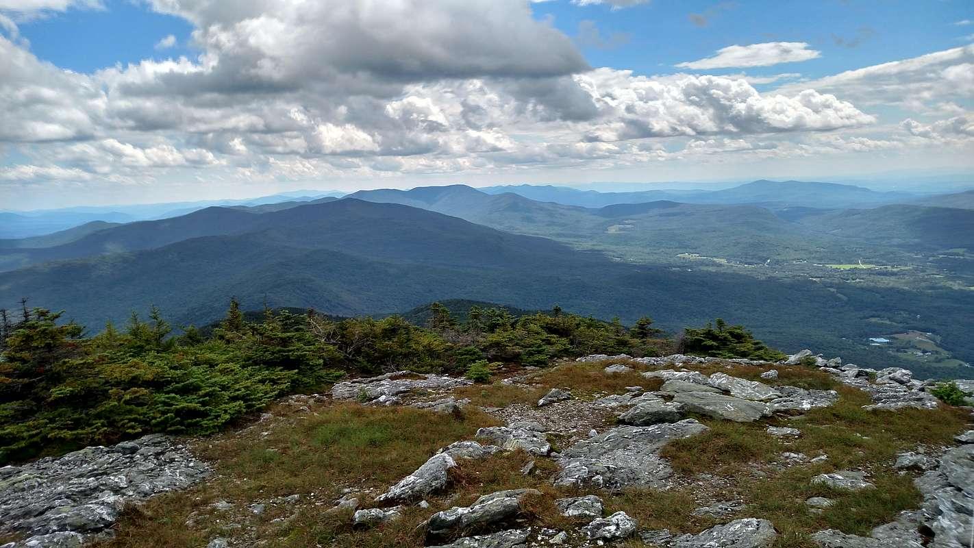
What distinguishes Mount Abraham from several other Vermont 4,000-foot peaks is its largely open summit. On clear days, hikers can see Lake Champlain and the Adirondack Mountains to the west, the White Mountains of New Hampshire to the east, and long stretches of the Green Mountains extending north and south. The summit’s expansive views are often regarded as some of the finest in the state.
Mount Abraham via Long Trail (Lincoln Gap)
- The Route: A 4.7 to 5.6-mile out-and-back trail starting at Lincoln Gap Road (Elevation: ~2,434 ft).
- Elevation Gain: ~1,600 to 2,200 ft.
- Estimated Time: 3.5 to 4.5 hours.
- Details: This is a classic, steep, and rocky ascent. You’ll pass the Battell Shelter around the 1.7-mile mark, which is an excellent spot to rest before tackling the final steep boulder scramble to the summit.
Mount Abraham via Battell Trail
- The Route: A 5.3 to 5.8-mile out-and-back trail that climbs the western flank.
- Elevation Gain: ~2,400 to 2,500 ft.
- Estimated Time: 4 to 4.5 hours.
- Details: Starting from the end of USFS Road 350 in Lincoln, VT, this trail is a bit longer but often offers more manageable, steady grades until it intersects with the Long Trail near Battell Shelter
Mount Pisgah
Location: Westmore
Distance: 4–5 miles
Difficulty: Moderate
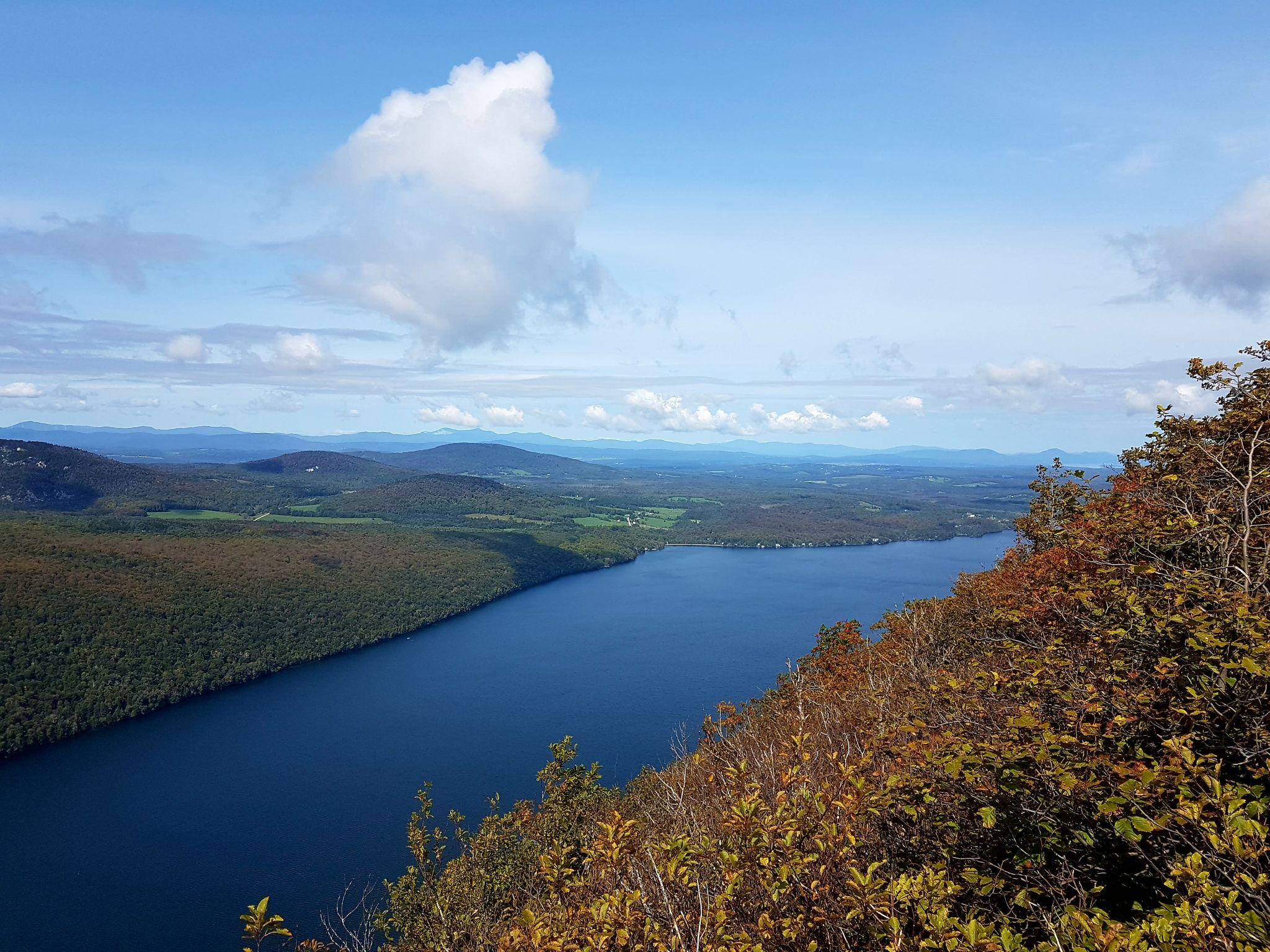
Mount Pisgah is a prominent mountain and scenic overlook on the eastern side of Lake Willoughby in Vermont’s Northeast Kingdom. Known for its dramatic cliffs and panoramic views, it forms one side of the striking Willoughby Gap and is widely regarded as one of the state’s premier hiking destinations. The overlook provides sweeping vistas of the glacial lake far below, along with distant views of Vermont’s Green Mountains and New Hampshire’s White Mountains.
Landscape and Geography
Mount Pisgah rises above the eastern shore of Lake Willoughby within Willoughby State Forest. The mountain’s steep cliffs and the deep, narrow lake create a landscape often compared to a fjord, a rarity in New England. Lake Willoughby itself was carved by glaciers and is one of the deepest lakes in the region, making the overlook especially dramatic.
Highlights
- Spectacular cliffs above Lake Willoughby
- One of Vermont’s most photographed views
- Dramatic lake-and-mountain scenery
- Outstanding fall foliage destination
The overlook resembles scenery often associated with the Adirondacks or White Mountains.
Hiking Access
Several trails reach the overlook. The South Trail is the most commonly used route and passes the well-known Pulpit Rock viewpoint before continuing to the summit. The North Trail is often considered the most scenic approach, while the East (Long Pond) Trail offers a gentler ascent. Depending on the route chosen, hikes typically range from roughly 3.5 to 6 miles round trip and are generally rated moderate.
Mount Hunger
Location: Waterbury
Distance: 4.4 miles round trip
Difficulty: Moderate to strenuous
Mount Hunger is one of the most popular hiking destinations in central Vermont. Located in the Worcester Range near Waterbury and Stowe, it rises to about 3,539 feet (1,079 m) and is known for its open, rocky summit and sweeping views of the Green Mountains.
What makes it special?
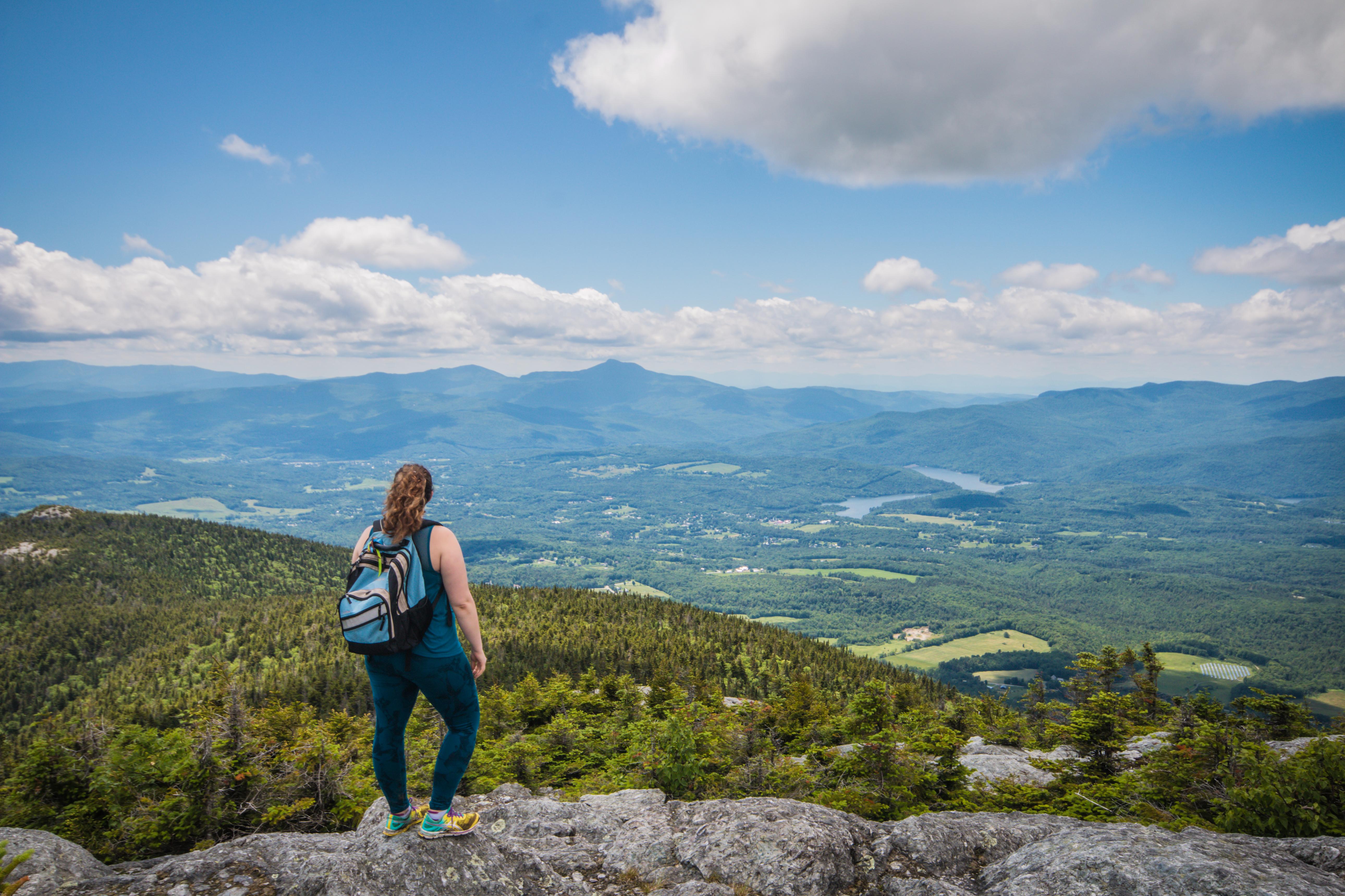
The summit offers expansive views of landmarks such as Mount Mansfield, Camel’s Hump, the Waterbury area, and much of the Green Mountain Range. On clear days, hikers may also see the Adirondacks and White Mountains.
Despite not being the highest peak in the Worcester Range, it is considered the range’s most frequently climbed mountain because of its excellent views and relatively accessible trailheads.
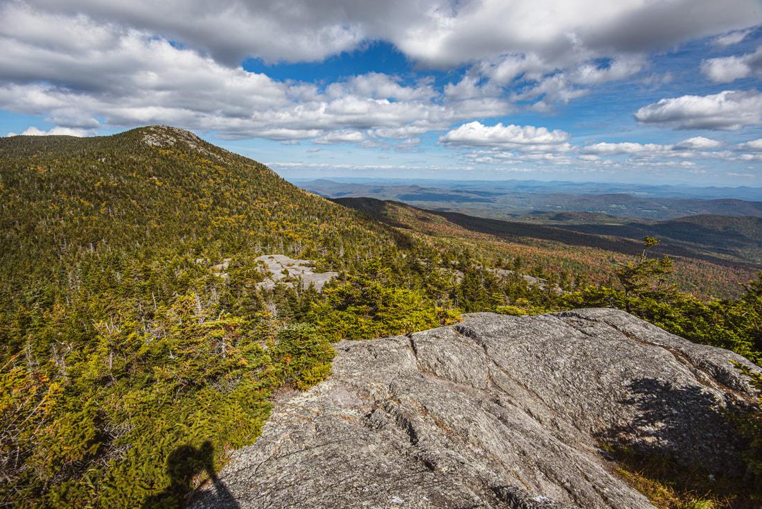
The summit is largely exposed granite, creating a dramatic alpine feel uncommon for a mountain of its height.
Highlights
- Excellent reward-to-effort ratio
- Open ledges with wide mountain views
- Popular sunset destination
- Great day hike near Montpelier and Burlington
Hiking Routes
The two main approaches are:
Waterbury Trail (west side)
Approximately 3.6–5 miles round trip depending on how measured.
Steady climb with over 2,000 feet of elevation gain.
Includes some rock scrambling near the summit.
The most popular route.
Middlesex Trail (east side)
Slightly longer but often considered a bit less direct.
Features steep rock slabs and scrambling sections near the top.
At the summit, both trails connect with the Skyline Trail, allowing ambitious hikers to continue toward Mount Worcester and Stowe Pinnacle.
Sterling Pond
Location: Smugglers’ Notch
Distance: 2–3 miles
Difficulty: Moderate
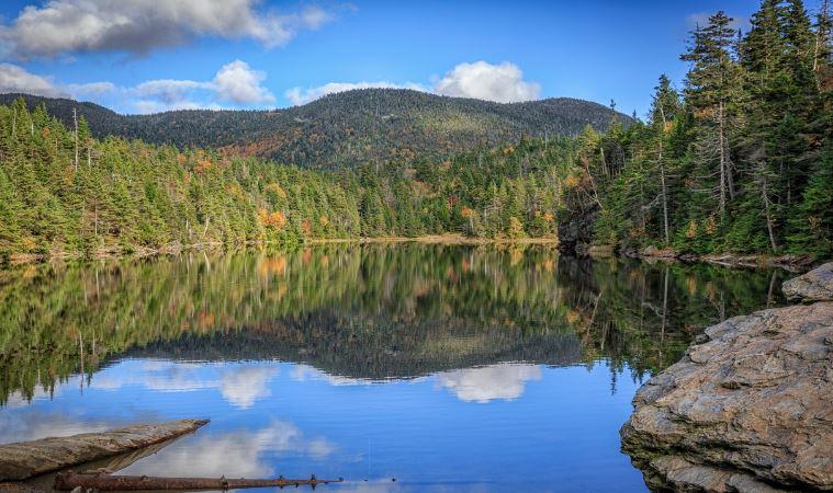
Sterling Pond is a mountain pond located high in Vermont’s Green Mountains within the Smugglers’ Notch area, between Stowe and Jeffersonville. It is one of the region’s most popular hiking destinations, known for its alpine setting, clear water, and dramatic mountain scenery. The pond is also notable as the highest trout pond in Vermont and sits near the route of the historic Long Trail.
What makes it special?
Nestled on the slopes of the Sterling Range, Sterling Pond lies above Smugglers’ Notch, the narrow mountain pass that separates Mount Mansfield from the Sterling Range. Surrounded by spruce and fir forest, the pond has a distinctly boreal character that feels more remote than its relatively accessible location suggests.
Highlights
- Crystal-clear mountain pond
- Massive cliffs and rock formations
- Family-friendly option
- Beautiful reflections in calm weather
Hiking Experience
The most common route is the Sterling Pond Trail, which begins near the top of Smugglers’ Notch on Vermont Route 108. The hike is short but steep, climbing roughly 900–1,000 feet over about 2.5 to 3 miles round trip. Stone stairways, rocky sections, and forested slopes lead to a junction with the Long Trail, from which the pond is a short walk away.
Mount Philo State Park
Location: Charlotte
Distance: 1.5–2 miles
Difficulty: Easy
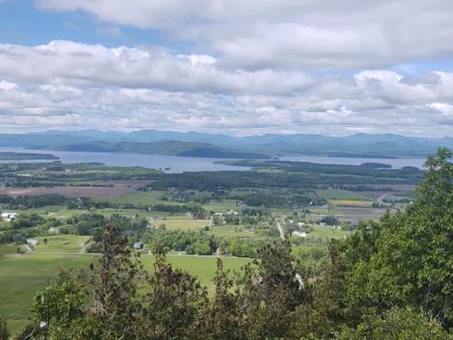
Mount Philo State Park is a scenic state park in Charlotte, Vermont, centered on the 968-foot summit of Mount Philo. Known for its exceptional views relative to its modest elevation, it offers panoramic vistas of Lake Champlain, the Adirondack Mountains of New York, and the Green Mountains of Vermont. The park is especially popular because visitors can either hike to the summit or drive up a seasonal access road.
What makes it special?
The summit is the park’s defining attraction. From the overlook, visitors can see broad stretches of the Champlain Valley, Lake Champlain, and distant mountain ranges in multiple directions. Picnic areas, accessible facilities, and short summit paths make the views available to a wide range of visitors.
Highlights
- Ideal for beginners
- Panoramic views of Lake Champlain
- Adirondack Mountain sunsets
- One of Vermont’s best short hikes
Mount Olga
Location: Wilmington
Distance: 2 miles
Difficulty: Easy
Location and Setting
Mount Olga rises above the park near Wilmington, Vermont, along the Molly Stark Scenic Byway (Vermont Route 9). The summit sits at roughly 2,415 feet (736 m) and is surrounded by northern hardwood and spruce-fir forests that reflect the area’s agricultural and conservation history. Stone walls encountered on the trail are remnants of 19th-century farming activity.
Highlights
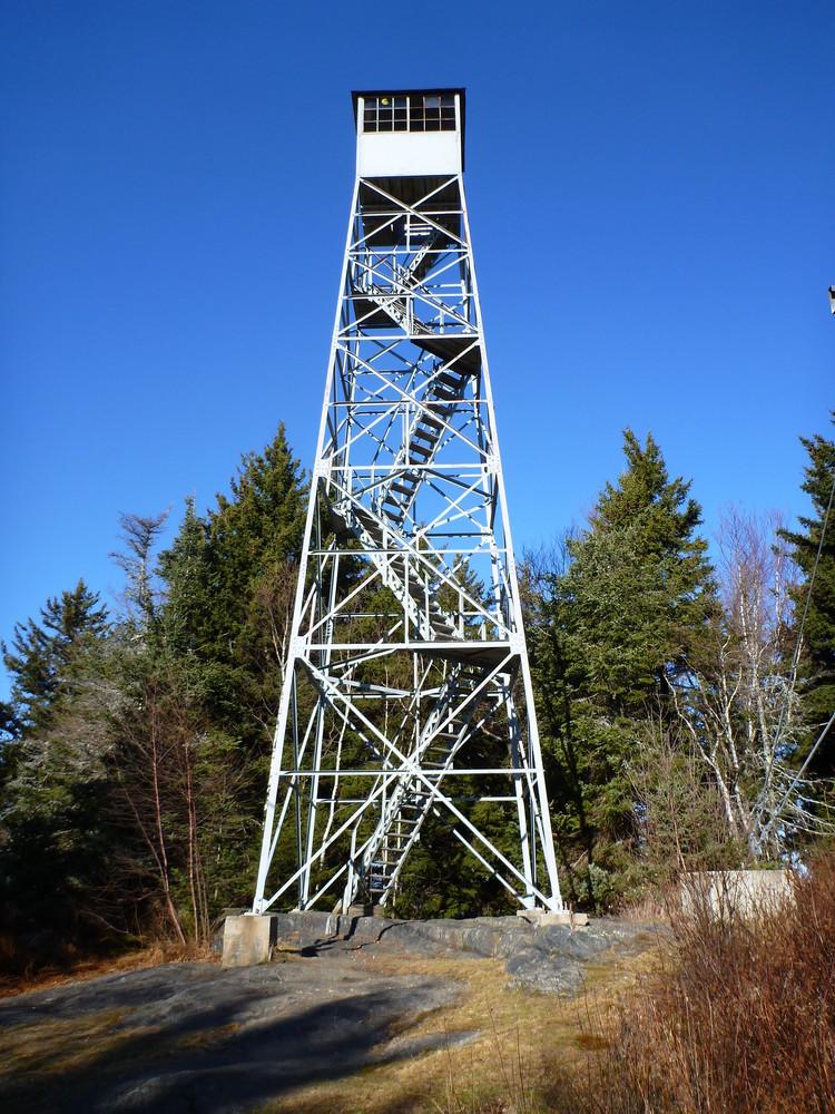
- Historic fire tower
- Views across southern Vermont
- Excellent foliage destination
- Family-friendly climb
Hiking Experience
The principal route is the Mount Olga Trail, a moderate loop of about 1.7 miles. Beginning near the park office, the trail crosses a brook, passes historic stone walls, and gradually climbs through mixed forest before reaching the summit spur. Most visitors complete the hike in roughly 1 to 1.5 hours, making it accessible to families and casual hikers while still providing a satisfying ascent.
Fire Tower and Views
A steel fire lookout tower stands on the summit and remains open for recreational viewing. From the tower, visitors can see the southern Green Mountains, Mount Snow, the Berkshires of Massachusetts, Mount Monadnock in New Hampshire, and the Searsburg Wind Farm on clear days. The tower is widely regarded as the mountain’s defining feature and the reason many hikers make the trip.
Bald Mountain
Location: Westmore
Distance: 3 miles
Difficulty: Easy to Moderate
Setting and Landscape
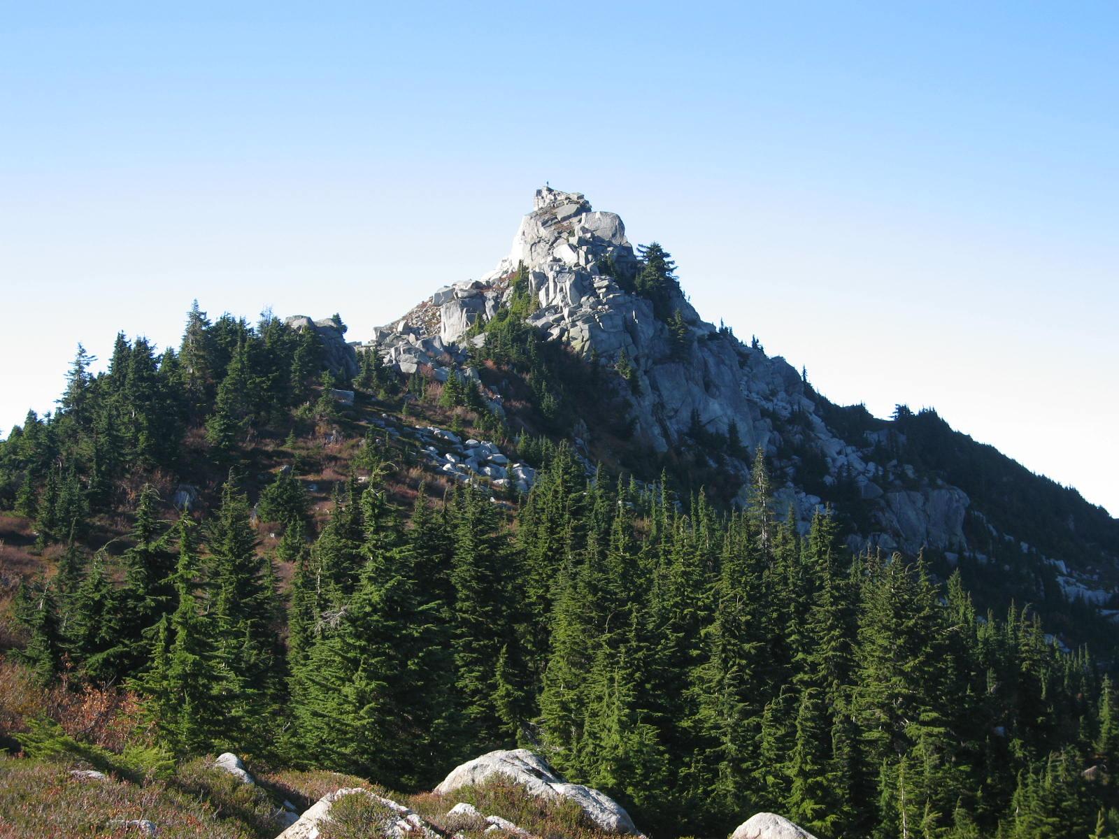
Bald Mountain rises within the rugged highlands of the Northeast Kingdom and forms part of the scenic landscape surrounding Lake Willoughby. Its summit sits above forests of northern hardwoods and spruce-fir, creating a transition from typical Vermont woodland to a more subalpine environment near the top.
Highlights
- Fire tower summit
- Views of Lake Willoughby
- Outstanding sunrise location
- Short hike with huge rewards
Summit Experience
The mountain is best known for its restored fire tower, which provides a nearly complete 360-degree panorama. On clear days, hikers can see Lake Willoughby, Seymour Lake, Lake Memphremagog, portions of the Green Mountains, and the White Mountains of New Hampshire. A restored shelter near the summit adds to its appeal as a destination hike
Hiking Routes
Three primary routes lead to the summit: the Long Pond Trail from the south, the Mad Brook Trail from the north, and the older Telegraph Trail. Most visitors choose either Long Pond or Mad Brook, both moderate-to-challenging hikes that climb roughly 1,400 feet through forests, stream crossings, and rocky sections before reaching the open summit area.
The Long Trail
Length: 272 miles across Vermont
Route and Landscape
The Long Trail runs approximately 272–273 miles along Vermont’s main mountain ridge. It traverses many of the state’s most famous peaks, including Mount Mansfield, Camel’s Hump, Killington Peak, and Jay Peak. Hikers encounter hardwood forests, alpine zones, mountain ponds, streams, and rugged terrain that is often steep and muddy.
Highlights
- Oldest long-distance hiking trail in the United States
- Traverses Vermont’s highest peaks
- Connects many of the state’s best viewpoints
- Ideal for day hikes, overnights, and thru-hikes
Many of Vermont’s most scenic sections run across the ridges of Camel’s Hump and Mount Mansfield, providing unforgettable alpine scenery.
Hiking Experience
The trail is marked primarily with distinctive white blazes painted on trees and rocks. About 100 miles of the southern route overlap with the Appalachian Trail before the two paths diverge in central Vermont. Completing every mile earns hikers recognition as “End-to-Enders,” a tradition maintained by the Green Mountain Club. A full thru-hike typically takes several weeks, though many people complete it in sections over multiple years.
Tips for a Memorable Hiking Experience
To ensure a safe and enjoyable hiking experience in Vermont, here are some essential tips to keep in mind:
- Pack plenty of water and snacks: Staying hydrated and fueled up is crucial for a successful hike. Make sure to pack enough water and energy-boosting snacks to keep you going.
- Wear appropriate footwear: It’s essential to wear sturdy hiking boots with good traction to navigate Vermont’s rugged terrain safely. Taking care of your feet will ensure a comfortable hike.
- Check the weather forecast: Vermont’s weather can be unpredictable, so it’s essential to check the forecast before heading out on a hike. Be prepared for changing conditions and dress in layers.
- Respect wildlife and nature: When hiking in Vermont, remember that you are a guest in the natural world. Respect wildlife, stay on designated trails, and leave no trace of your visit.
By following these tips and exploring Vermont’s most scenic hikes, you can create unforgettable memories and connect with the beauty of the Green Mountain State. Whether you’re seeking a leisurely stroll through a meadow or a challenging climb to a mountain peak, Vermont has something for everyone. So lace up your hiking boots, pack your camera, and get ready to experience the natural splendor of Vermont like never before!